
Umm Qais is the modern name for the ancient city of Gadara, perched on a ridge approximately 378 meters above sea level in Jordan's northwestern tip. This guide is crafted for a specific type of traveler: those willing to spend half a day on foot in an exposed, uneven landscape, who aren't content with merely seeing a ruin but ask who built it and which earthquake brought it down. If you expect a meticulously arranged museum, abundant signage, and short walks, the northern route might prove challenging. The allure of Gadara and its neighbor Abila stems not from being perfectly curated, but from their raw, untouched state. Below, you'll discover how to fit both cities into a single day and what to look for at different times.
Quick Facts
| Topic | Information |
|---|---|
| Location | Northwestern Jordan, Umm Qais village in Irbid Governorate |
| Ancient Name | Gadara; member of the Decapolis (Ten Cities) league |
| Elevation | Approximately 378 meters above sea level |
| Distance from Amman | Approximately 110 kilometers north, about 2 hours by car |
| Distance from Irbid | Approximately 25 kilometers northwest |
| UNESCO Status | Not on the World Heritage List, on the Tentative List since 2001 |
| Building Material | Local black basalt, with white limestone in places |
| Second City on Route | Abila (Qweilbeh), approximately 13 kilometers north of Irbid |
| Recommended Duration | 3-4 hours for Gadara; a full day if Abila is added |
| Admission | Umm Qais covered by Jordan Pass; Abila not listed |
Umm Qais vs. Abila: What Do These Two Decapolis Cities Offer Differently?
The two cities are not mere repetitions of each other: Gadara is an excavated and organized archaeological site, while Abila largely remains buried beneath the earth, blending into olive groves.
| Criterion | Umm Qais (Gadara) | Abila (Qweilbeh) |
|---|---|---|
| Visibility | Excavated, partially restored, clear walking paths | Largely underground, limited signage |
| Key Features | Basalt Western Theatre, colonnaded street, basilica terrace | Byzantine churches, bathhouse, underground water system |
| Views | Yarmuk Valley, Golan Heights, Sea of Galilee | Olive groves and the valley between two tells |
| Visitors | Regularly visited by tours | Mostly deserted on most days |
| Infrastructure | Ticket office, restrooms, dining in the village | Minimal to no infrastructure |
| Time Allotment | 3-4 hours | 1.5-2 hours |
| Best For | First-time visitors to the region | Enthusiasts of excavation sites and early church architecture |
The practical rule of thumb is this: Gadara demands the cool morning hours, as there's no shade and the views tend to haze over in the afternoon; Abila, on the other hand, fits perfectly into the latter half of the day as the sun begins to set.
What to See in Gadara
Gadara flourished during the Hellenistic period, developed under Roman rule as a member of the Decapolis, and later became an episcopal center in the Byzantine era. The city's intellectual renown isn't just a tourism slogan; it's a historical record based on ancient sources. Figures like the satirist Menippus, epigrammatic poet Meleager, Epicurean philosopher Philodemus, and Emperor Tiberius's rhetoric teacher, Theodorus, are all associated with this city. Meleager, in his epitaph, described Gadara as "an Attica among the Assyrians" – the frequently used phrase "new Athens" is a loose translation of this analogy.
Two key events shaped its current appearance: the great earthquake of 749 AD destroyed much of its structures, burying the area under earth. Later, during the Ottoman period, a village was built atop the acropolis, with its dwellings constructed using and on top of the ancient city's stones. For those looking to trace similar Roman city planning in Turkey, the cultural tours in Turkey category offers programs focused on ancient cities.
The Western Theatre
The city's iconic landmark is the basalt theatre carved into the western slope of the acropolis. This structure was built in the 2nd century with finely cut basalt blocks; its seating area is divided into wedges by staircases and has a capacity of approximately 3,000 spectators. A vaulted corridor beneath the seating provided access to the upper rows from the surrounding streets. Buried after the 749 earthquake, the structure was later excavated, and its facade partially reconstructed.
Since a portion of the seating rows remains intact, it's possible to sit here and gaze out over the valley. As the cavea faces west, the afternoon sun shines directly into your eyes; the texture of the stone is much clearer in the morning hours. The stones of the city's second and larger theatre, located to the north, were dismantled and reused in later periods, so today only faint traces can be discerned.
The Colonnaded Street and Nymphaeum
The stone-paved main street, cutting across the city on an east-west axis, formed the backbone of Roman urban planning. Ruts carved by chariot wheels are still visible in the paving stones. During the Byzantine period, the street was lined with vaulted shops, which also supported the terrace above.
The monumental fountain on the street, along with the public water network uncovered during excavations, is identified as the city's nymphaeum. In the surviving sections, one can observe semi-circular niches facing the street and fragments of cornices. The ground is uneven, and the basalt can become slippery after rain, so sturdy footwear will make your visit much easier.
The Basilica Terrace and Octagonal Structure
Above the main street, the western terrace, leveled by carving into the rock, housed the city's religious center: a colonnaded courtyard, a central octagonal structure, and a three-aisled basilica. The outer circulation corridor is covered with colorful geometric pavements; the basalt columns surrounding the octagonal area are believed to have supported a dome. Sources provide varying dates for the terrace structures, ranging from the 6th to the 8th century.
The combined use of black basalt and white limestone is clearly visible here: basalt is abundant locally due to the volcanic nature of the region, while limestone was preferred for areas requiring finer craftsmanship.
The Ottoman Village and Umm Qais Museum
The Ottoman village atop the acropolis represents a distinct layer of the archaeological site, with some of its buildings used by the Jordanian Department of Antiquities. One of the village's mansions, Beit er-Russan, was converted into a museum in 1990 after a joint restoration by the Department and a German archaeological institution. Its two exhibition halls display ceramics and Roman-era sculpture fragments unearthed from the region.
Timing note: whether the museum is open on any given day can vary; check its status via Visit Jordan before you arrive.
Views of Yarmuk, Golan, and Galilee from the Northern Terrace
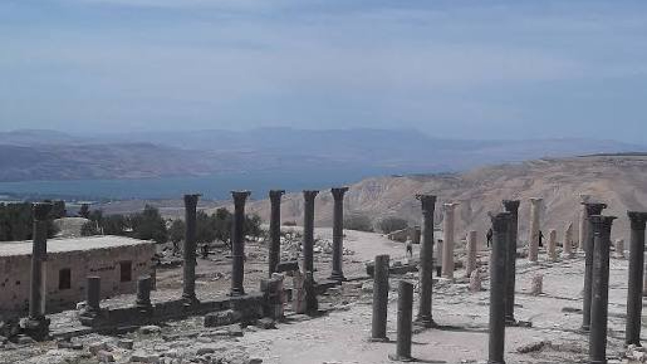
The city's north-facing terrace is the primary reason Umm Qais stands out from other archaeological sites of similar scale. From here, you can take in the Yarmuk River valley, the Golan Heights, Mount Hermon, and the Sea of Galilee, along with the northern plains, all within the same panoramic frame. All these names lie beyond Jordan's borders: the Yarmuk valley delineates the country's northern frontier, the Golan Heights and Mount Hermon are situated beyond the valley, and the Sea of Galilee lies within Israeli territory to the west. Clarity is time-dependent: the early morning hours and close to sunset offer crisp views, while midday is often hazy.
Umm Qais village was included in the United Nations World Tourism Organization's 2022 "Best Tourism Villages" list, recognized for its community-based rural tourism initiatives. The village borders the Yarmuk Forest Reserve, which was declared in 2010 and covers an area of approximately 20.5 square kilometers.
Abila (Qweilbeh): The Decapolis City Beneath the Olive Groves
Abila is located in the valley near Hartha village, approximately 13 kilometers north of Irbid. Despite being a member of the same league as Gadara, its renown is lesser, primarily because the city largely remains buried underground. It was added to UNESCO's Tentative List under the name "Abila City (Modern Qweilbeh)" on the same day as Gadara, June 18, 2001. It does not appear on the list of sites covered by the Jordan Pass, so admission arrangements should be confirmed on-site.
A City Between Two Tells
The site consists of two elevated areas: Tell Abila to the north, Khirbet Umm el-Amad to the south, and a saddle connecting the two. Traces of settlement date back to approximately 4000 BC and continued until around 1500 AD, indicating continuous occupation from the Early Bronze Age to the Islamic period. Surface surveys began in 1980, with systematic excavations conducted between 1982 and 2000.
Churches, Theatre, and Bathhouse
Excavations have unearthed five Christian churches, including a 6th-century basilica with three apses and a church dated to the 7th-8th centuries. The site also records a Greco-Roman theatre with visible seating tiers, a Byzantine chapel, an Islamic-era fortress-like structure, a Roman-era fountain and villa, and an olive press. Over a hundred tombs have been excavated in the necropolis, with the total number estimated to be over a thousand.
The olive groves rise above this burial ground, meaning you walk over the necropolis as you wander among the trees. As there are no signs or marked paths, you'll need to orient yourself by the tells. For those seeking similar historical textures in Turkey, the historical city tours in Turkey category is a great starting point.
Qanat Fir'aun: The Aqueduct That Fed Both Cities
The invisible structure connecting the two cities is the water line that supplied both. Research indicates the system is approximately 170 kilometers long, with a 106-kilometer section running through tunnels. It was built in stages between 90 and 210 AD and is described as the longest known tunnel of the ancient world. Most of the line is closed to visitors.
Getting There: Via Amman and Irbid
By Car
From Amman, the road north passes through Irbid; the distance is approximately 110 kilometers, taking about 2 hours under normal conditions, or up to 2.5 hours during peak times. The remaining 25-kilometer stretch from Irbid to Umm Qais takes about forty minutes, entering narrow village roads in the final section. For Abila, turn north from Irbid towards Hartha; the final connection might be unpaved.
By Public Transport
Public transport is an option but requires flexibility. Minibus and bus services from Amman's northern terminal to Irbid take approximately one to one and a half hours. In Irbid, you'll need to transfer to the northern terminal and catch an Umm Qais minibus, which takes between thirty and forty minutes. As afternoon services become less frequent, plan your return for early afternoon. Reaching Abila by public transport is not practical; a private car or local taxi is suitable for this stop.
Visiting Hours and Itinerary Planning
Visiting hours vary by season. The table below is based on the hours published on the official Jordan Pass website, jordanpass.jo; as it's updated periodically, confirm before your visit.
| Period | Umm Qais Visiting Hours |
|---|---|
| November - April (Winter) | 08:00 - 16:00 |
| April - May | 08:00 - 17:30 |
| Summer Period | 08:00 - 18:30 |
| Ramadan | 09:00 - 17:00 |
The official list shows April in both winter and spring ranges; for an April visit, specifically inquire about the closing time. Since the site closes at 16:00 during winter hours, those planning to add Abila on the same day should enter Gadara by 9:00 AM.
When to Visit
The most favorable periods for travel in the country are between March and May, and September and November. Northern Jordan is rainier and greener than the rest of the country, and spring looks distinctly different here.
| Period | Conditions in Northern Jordan | Notes for Gadara and Abila |
|---|---|---|
| March - May | Mild weather, green hills, wildflowers | Comfortable for walking; closing extends to 17:30 in April and May |
| June - August | Hot and dry, no shade on site | Enter at opening in the morning, avoid midday hours |
| September - November | Mild weather, clear light | Favorable period for northern terrace views |
| December - February | Cool and rainy, fog possible | Basalt becomes slippery when wet; closes at 16:00 |
Morning in the Citadel, Afternoon in the Olive Groves: A Day on the Northern Route
The following itinerary is for those departing from Amman and returning the same day; if you're staying in Irbid, start the sequence an hour later.
- Depart from Amman around 07:00 AM; save your breakfast stop for the Irbid exit.
- Arrive at the Umm Qais entrance around 09:00 AM and head directly to the northern terrace; the views will be clearest then.
- Allocate about forty minutes for the Western Theatre; the side lighting will highlight the stone textures.
- Walk along the colonnaded street heading east, observe the chariot ruts and the fountain structure, then ascend to the basilica terrace.
- Wander through the Ottoman village; if the museum is open that day, dedicate half an hour to its exhibition halls.
- Take a lunch break in the village around 12:30 PM; terraces overlooking the valley offer welcome shade.
- By 14:00, proceed to Abila via Hartha and allocate an hour and a half for the site.
- Return to Irbid before sunset; avoid driving on narrow village roads in the dark.
Where to Eat, Where to Stay
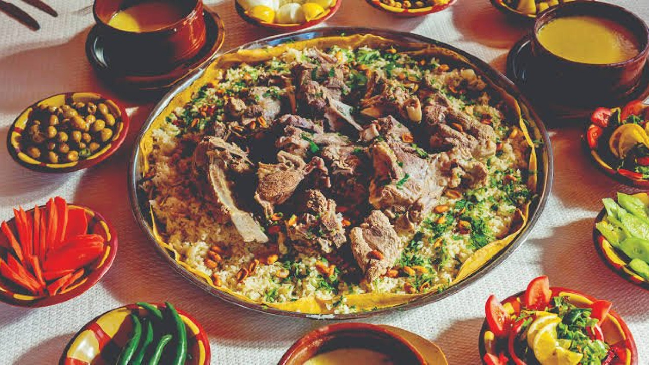
In Umm Qais village and at the entrance to the archaeological site, there are establishments offering local cuisine; terraces overlooking the valley are ideal for a lunch break. The region's standout dish, considered the national dish of Jordan, is Mansaf: served with jameed sauce, lamb, and rice, atop shrak bread. As there are no restaurants around Abila, bring your own water and food, and plan your main meal for your return to Irbid.
Three regions stand out for accommodation:
- Umm Qais village: offers a few small guesthouses and community-based accommodations; suitable for those wanting to catch the morning opening and sunset views.
- Irbid city center: provides the widest range of options and is considered a natural base for visiting Abila.
- Amman: serves as the base for those taking a day trip north; in return, you'll spend more time on the road.
Accommodation costs are determined by the season and type of facility; check the establishments' direct channels for current rates. For those expanding their Middle East itinerary through ancient cities, our Egypt travel guide and for those interested in comparing Roman urban planning, our Italy travel guide can be helpful.
Essential Tips Before You Go
- Visa requirements vary by nationality and are updated periodically; confirm via Visit Jordan before your trip.
- Umm Qais admission is covered by the Jordan Pass; Abila does not appear on the same list. Check official sources for current ticket prices.
- Shade is scarce at the sites: a hat, sunscreen, sturdy footwear, and sufficient water are essential gear.
- Inquire in advance whether the museum will be open on your visiting day.
- The northern terrace is close to Jordan's northwestern border; do not venture outside marked areas.
- A local guide service can help you distinguish between the Hellenistic, Roman, Byzantine, and Ottoman layers.
- Both sites feature uneven terrain and original stone paving; they are not suitable for wheelchairs or strollers.
Frequently Asked Questions 6
How long does it take to visit Umm Qais?
3-4 hours are sufficient for the main stops, terraces, and museum. If Abila is added on the same day, the itinerary will be a full day.
How do I get to Umm Qais from Amman?
By car, the approximately 110-kilometer journey via Irbid takes about 2 hours. By public transport, you'd take a minibus from Amman's northern terminal to Irbid, then transfer to an Umm Qais minibus from Irbid's northern terminal; this second leg takes thirty to forty minutes.
Is Umm Qais admission included in the Jordan Pass?
Umm Qais is listed as covered on the official Jordan Pass website. Abila does not appear on the same list; confirm admission arrangements on-site.
Is Umm Qais a UNESCO World Heritage Site?
No. Gadara was added to Jordan's UNESCO Tentative List on June 18, 2001, and holds candidate status. Abila was also added to the same list on the same date.
What is the best time to visit Umm Qais and Abila?
March to May and September to November are favorable. For summer visits, aim for the morning opening; in winter, account for the 16:00 closing time.
Are the sites suitable for disabled visitors?
Both sites are on uneven terrain with original stone paving. Navigating with a wheelchair or stroller is difficult; Abila has no organized paths.