
The Jordan Trail is an epic long-distance hiking route stretching from Umm Qais in northern Jordan all the way south to Aqaba on the shores of the Red Sea. According to data published by the Jordan Trail Association, which manages the route, the trail spans over 675 kilometers, is divided into 8 regions and 35 stages, and passes through 75 villages and towns. This comprehensive guide answers key questions for both intrepid trekkers planning to hike the entire trail and those looking to explore just a section for a few days: How long is each region? When is the best time to visit which area? Where can you find water? What are the accommodation options? And how should you prepare for this unforgettable adventure?
Quick Facts
| Topic | Information |
|---|---|
| Route | Long-distance hiking trail between Umm Qais and Aqaba |
| Total Length | Over 675 kilometers |
| Structure | 8 regions, 35 stages, 75 villages and towns |
| End-to-End Duration | 35 hiking days |
| Managing Body | Jordan Trail Association, established July 2015 |
| Markings | Trail is unmarked; local guide recommended |
| Best Season | North: March-April; South: February-March; also mid-September-November |
| Daily Water | 5 liters for a full day without resupply; 3-4 liters in cooler weather |
| Emergency | Tourist Police hotline 117777 |
What is the Jordan Trail and Who Manages It?
The trail emerged from the thoughtful connection of scattered footpaths, shepherd trails, and ancient trade routes into one cohesive long-distance route. Its maintenance, mapping, and promotion are overseen by the Jordan Trail Association, established in July 2015. This incredible route guides adventurers from the northern forests through steep valleys overlooking the Rift Valley, past the ancient wonders of Petra, across the sandy plains of Wadi Rum, and finally to the Red Sea coast.
The Jordan Trail Association and the Reality of an Unmarked Path
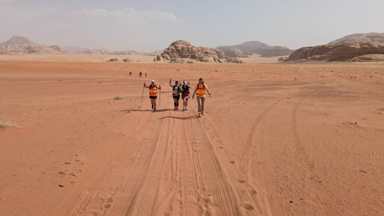
One of the most frequently overlooked pieces of information about the Jordan Trail is that the path itself is not marked on the ground. The Association openly states this: many sections are remote and uninhabited, water sources are limited, and phone coverage can be intermittent. Downloading up-to-date GPS files and proceeding with a local guide are the official recommendations for navigating the route safely. Practical tip: Since the route can be revised, make sure to re-download the stage files right before you set off.
Difficulty, Daily Pace, and Who the Trail is For
When dividing the regional lengths by the number of days, the average daily pace falls between 15 and 20 kilometers. However, this distance isn't covered on flat terrain; instead, you'll be traversing landscapes with significant ascents and descents. For instance, between Ajloun and As-Salt, the total climb reaches 2,625 meters. This route is best suited for experienced trekkers accustomed to hiking for consecutive days with a fully loaded backpack. For those with limited experience, tackling just one region offers a more realistic and enjoyable introduction to the Jordan Trail.
Eight Regions, Thirty-Five Stages: Distance and Day Table
The distances and day counts are sourced from the Association's current regional pages; their total is approximately 660 kilometers, with the Association's general figure of 675 kilometers accounting for route revisions. The "Challenging Factors" column is compiled from elevation and water information found on the same pages.
| Region | Route | Distance | Duration | Challenging Factors |
|---|---|---|---|---|
| 1 | Umm Qais - Ajloun | 78.2 km | 4 days | Constant ascents and descents |
| 2 | Ajloun - As-Salt | 62.1 km | 4 days | 2,625 m total ascent |
| 3 | As-Salt - Wadi Zarqa Ma'in | 84.4 km | 4 days | Descent into valley, dry climate |
| 4 | Three Valleys - Karak | 75 km | 4 days | Wadi Mujib crossing |
| 5 | Karak - Dana | 83.9 km | 4 days | Wadi Hasa canyon |
| 6 | Dana - Petra | 72.4 km | 4 days | Climate zone change |
| 7 | Petra - Wadi Rum | 91.6 km | 5 days | Remote section, water scarcity |
| 8 | Wadi Rum - Red Sea | 112 km | 6 days | Sand and granite terrain |
The Northern Route: A Green Beginning from Umm Qais to Ajloun
The first region of the trail covers 78.2 kilometers over four days. It winds through olive groves, oak forests, and agricultural valleys, bursting into bloom during the spring months. This stage immediately challenges the arid image often associated with the Middle East, offering a refreshing and natural introduction to get accustomed to your hiking rhythm.
Umm Qais: The Basalt Ruins of Ancient Gadara
The starting point, Umm Qais, is built upon the ancient Roman Decapolis city of Gadara, renowned for its distinctive black basalt structures. Here, you can explore the remains of a colonnaded street, vaulted terrace, and two theaters. From its elevated position, the site offers a breathtaking panorama encompassing the Jordan Valley, the Sea of Galilee across the border, the Golan Heights, and Mount Hermon. In 2022, the village was recognized by the World Tourism Organization on its list of exemplary tourism villages. Practical tip: Explore the ruins in the afternoon and begin your trek early the following morning to beat the heat.
Ajloun Castle and Ajloun Forest Reserve
The endpoint of the first region, Ajloun, is famous for its castle, known as Qal'at ar-Rabad. This fortress was built in 1184 by Izz al-Din Usama, one of Saladin's commanders, to protect northern Jordan from Crusader threats. It was expanded to its current layout in 1214, with the Mamluks adding gates and towers in the 13th century. The nearby Ajloun Forest Reserve, spanning approximately 12 square kilometers, safeguards communities of oak, pistachio, and carob trees. Operated by the Royal Society for the Conservation of Nature, the reserve offers bungalow accommodation and features a Soap House that produces Orjan olive oil soap. Timing note: Consider taking a rest day here before continuing to the second region.
The Central Stages: As-Salt, Wadi Mujib, and the Karak Line
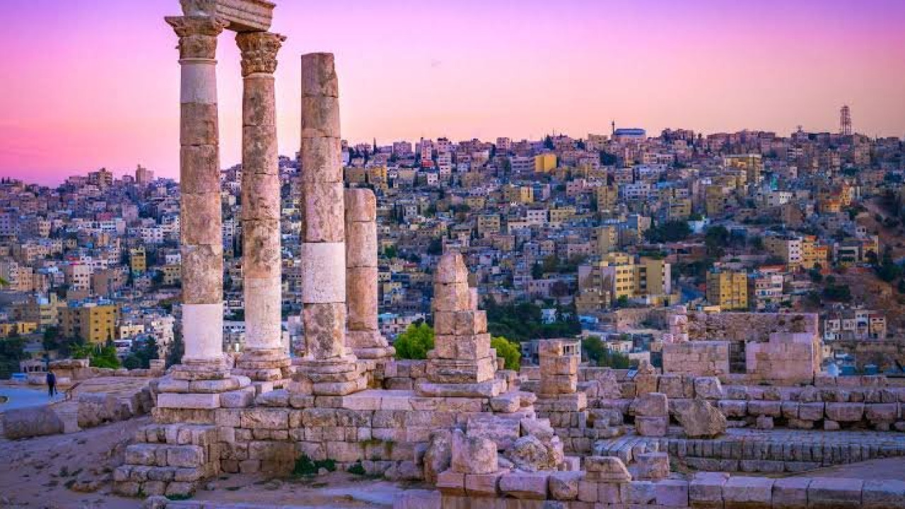
The second region descends from Ajloun, passing through Burma village and by the King Talal Dam, concluding in As-Salt. This city, which prospered through trade during the late Ottoman period, was inscribed on the UNESCO World Heritage List in 2021 for its approximately 650 historic yellow limestone buildings. Known for its harmonious coexistence of Muslim and Christian communities, As-Salt is also famous for its "Madafa" tradition of guest rooms.
The third region descends into the Jordan Valley from beside the Hellenistic palace ruins at Iraq Al-Amir, where the climate noticeably warms. The fourth region traverses the 800-meter-deep Wadi Mujib, a truly spectacular canyon. The fifth region descends from the southern walls of Karak Castle, crosses the 1,000-meter-deep Wadi Hasa canyon, and finally arrives at Dana.
The Desert Route: Ancient Paths from Dana to Petra
The sixth region spans 72.4 kilometers and takes four days to complete; it's one of the most frequently hiked sections of the trail. The Association proudly notes that this section was featured on National Geographic's list of the world's 15 leading hiking routes. The route descends from Dana, passing through Wadi Malaga and Ras Al-Feid to Little Petra, and then onwards to the magnificent Petra itself.
Dana Biosphere Reserve
Dana, established by the Royal Society for the Conservation of Nature in 1989, is Jordan's largest nature reserve, covering approximately 292 square kilometers, and was recognized as a UNESCO Biosphere Reserve in 1998. The area descends in ridges from a 1,500-meter plateau along the Great Rift Valley to the desert plains of Wadi Araba. This significant elevation difference allows trekkers to pass through multiple climate zones within just a few days. An entrance fee is charged for the reserve; check the Association's official website for current rates. Timing note: The descent can be challenging in the midday heat, so starting early in the morning is a common strategy.
Feynan and Its Four-Thousand-Year-Old Copper Mines
Wadi Feynan stands as one of the ancient world's longest-running copper production centers, remarkably well-preserved due to the absence of modern mining. The Feynan Ecolodge in the region is a partnership between the Royal Society for the Conservation of Nature and an operator; it's off-grid, generating its electricity from solar panels, and common areas are illuminated by candlelight in the evenings. Visitors can explore the four-thousand-year-old mine galleries accompanied by a Bedouin guide. Practical tip: Capacity is limited, so reservations are essential.
From Little Petra to the Ad-Deir Back Trail
The final stage of this region descends from Little Petra to Petra. The back trail, entering the ancient city from the north, ascends via the Ad-Deir steps, opening up stunning views of Wadi Araba to the west. At the end of the climb, you'll be rewarded with the sight of the magnificent 48-meter-high Monastery facade. Entry to Petra requires a separate ticket; for Jordan Pass holders, entry is included. Others can purchase tickets at the visitor center.
The Southern Stages: From Wadi Rum to the Red Sea
The seventh region covers 91.6 kilometers over five days and is described as one of the trail's longest and most remote sections. Elevations vary between 274 and 1,032 meters, with a total ascent of 2,354 meters. The Colored Canyon, Wadi Aheimar, and the ruins of Humeima are located along this route. The longest waterless stretch in this region is between Humeima and Shakriya, requiring trekkers to carry approximately a day and a half's worth of water.
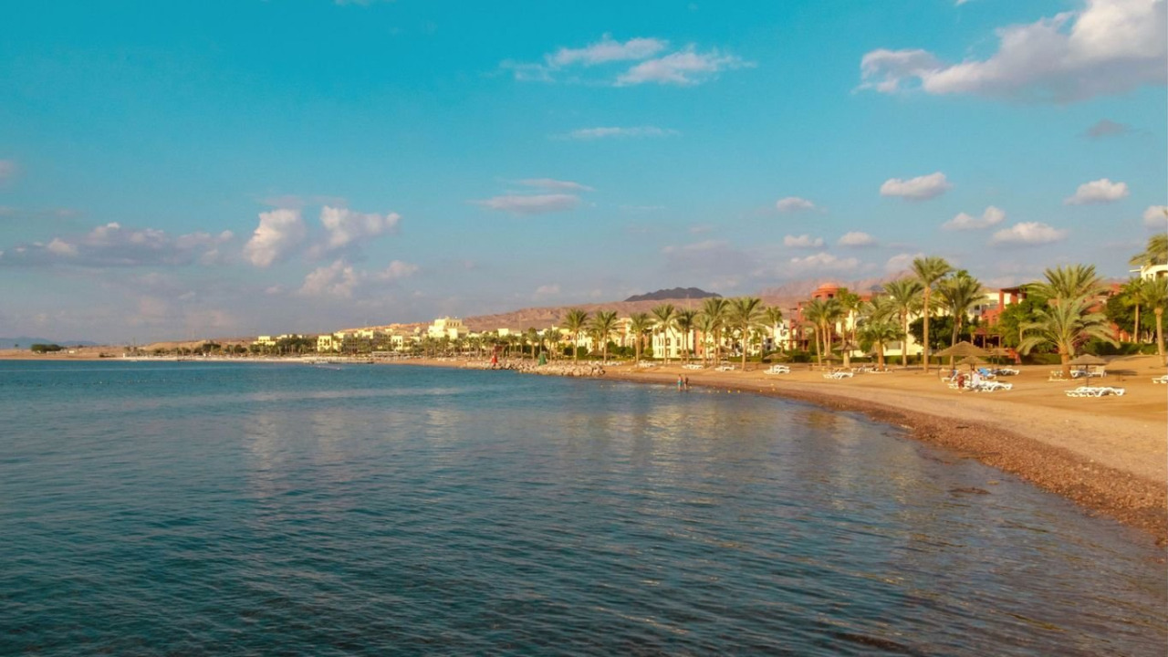
The eighth region, at 112 kilometers and six days, is the longest section of the trail. The route descends south through Wadi Rum, passing beneath the towering cliffs of Jebel Rum and Um Ishrin, and eventually reaches Aqaba through granite hills. The Wadi Rum Protected Area was inscribed on UNESCO's mixed heritage list in 2011; within its 74,000-hectare expanse, 25,000 rock carvings and 20,000 inscriptions document 12,000 years of human presence.
When to Hike? Seasonal Planning
The best season for hiking varies between the northern and southern sections of the trail. The Association highlights March and April for the north, and February and March for the south. The period from September to mid-November is also considered favorable for both.
| Period | Northern Regions | Southern Regions | Note |
|---|---|---|---|
| February - March | Cool, rainy | Favorable | Preferred window for the South |
| March - April | Green landscape, blooming flowers | Warms up | Preferred window for the North |
| May - August | Temperatures rise | Risky in the desert | Increased water consumption and lack of shade |
| Mid-September - November | Dry and balanced | Dry and balanced | Second suitable window |
| Late November - January | Rainy and cold | Nights get cold | Monitor flood warnings in canyons |
Transportation, Accommodation, and Trail Nutrition
Entry to Jordan and Reaching Stage Start Points
The country's main gateway is Queen Alia International Airport, near Amman. For the southern stages, Aqaba also serves as an accessible starting point via air. Long distances within the country are mostly covered by bus: the JETT network operates routes from Amman's Abdali, Tabarbour, 7th Circle, and Wehdat offices to Aqaba, as well as lines from Irbid and Zarqa heading south; Petra and Wadi Rum are also among its stops. Travel to Umm Qais is typically completed via local services from Irbid. Private transfers are common for stage beginnings and ends, as the finishing point of a hike is often a valley mouth not served by public transport.
Accommodation Options and Camping Arrangements
Accommodation along the trail is structured in three main categories: homestays in local villages, facilities operated by nature reserves, and camping with your own tent. In the north, village accommodations around Umm Qais and Ajloun, along with bungalows in the forest reserve, are prominent. In the central section, the historic center of As-Salt offers various options. In Dana, village guesthouses and the ecolodge within the reserve are popular choices. Further south, Wadi Musa, adjacent to Petra, is a hub for hotels. Wadi Rum offers authentic Bedouin camps, and Aqaba provides coastal accommodation to round off your journey. Always check the walking distance to your stage's endpoint before making a reservation.
Water Management and Trail Nutrition
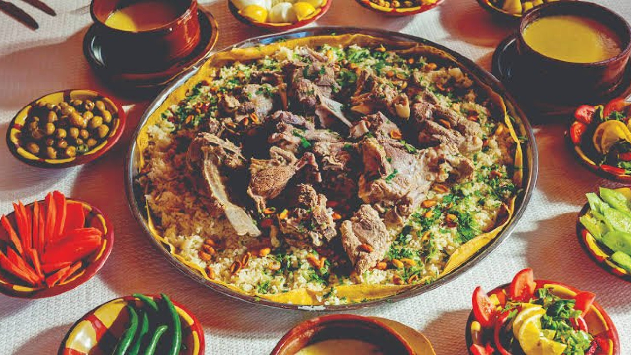
Water is absolutely central to planning your Jordan Trail adventure. The Association recommends carrying 5 liters for a full day without resupply, or 3 to 4 liters in cooler weather. While the country may appear arid, regular water sources can be found in the western mountains and valleys. The most challenging section for water is between Rum (Wadi Rum) village and Aqaba, where pre-arranged water drops are often necessary. It's highly advisable to purify any found water using tablets, a UV device, or a filter. In villages, you'll find fresh produce and hot meals; the national dish Mansaf, along with lentil and chickpea-based dishes, are wonderfully satisfying after a long day on the trail.
Preparation: A Step-by-Step Plan and Essential Gear
Organizing your preparation systematically will minimize wasted time on the trail.
- Choose the region you plan to hike and mark the number of days on your calendar; the entire trail requires 35 hiking days.
- Determine your dates based on the seasonal table: March and April for the north, February and March for the south.
- Download the latest stage maps and GPS files; this step is non-negotiable as the trail is unmarked.
- Contact guides and logistics providers from the Association's lists; plan accommodation and water drop points during the same discussion.
- Note down paid entry areas: Dana, Petra, and Wadi Rum have separate admission requirements.
- Complete your visa and documentation before departure, arrange travel insurance, and share your route plan with a trusted contact.
Here's the minimum essential gear for your backpack:
- Ankle-supporting hiking boots and spare socks
- Layered clothing: breathable light clothing for daytime, a warm outer layer for evenings
- Hat, sunglasses, and high-SPF sunscreen
- A 5-liter water carrying system along with purification tablets or a filter
- Phone with offline maps, a backup power source, and a first-aid kit
- For camping: a lightweight tent, sleeping bag, and sleeping mat
The Association recommends monitoring current travel advisories and securing travel insurance; the Tourist Police hotline is 117777. Always follow flood warnings in canyons. When passing through villages, wearing clothing that covers your shoulders and knees will facilitate interaction with locals; always ask for permission before taking photographs.
Visa, Jordan Pass, and Entry Fees
Visa requirements vary by nationality and are updated periodically; confirm these details before your trip via the Jordan Pass website and official Jordanian tourism resources. The Jordan Pass bundles entry to over 40 archaeological sites and the tourist entry visa fee into one convenient product. To qualify for the visa exemption, the pass must be purchased before arrival, and you must stay in the country for a minimum of two nights; a pass purchased upon arrival does not grant exemption. The cost depends on the package type; check the official website for current rates. Petra entry is included with the pass, but nature reserves have separate admission arrangements.
Fitting the Route into Your Own Schedule
Here's the sequence: choose your region, determine your dates according to the seasonal window, download the latest maps, arrange guide and water logistics, and sort out entry requirements in advance. For those looking to integrate this trek into a broader regional itinerary, our Egypt travel guide offers insights into planning in a neighboring geography, while the Balkans tour guide outlines steps for creating multi-country routes. If you're seeking similar adventures closer to home in Turkey, our categories for Nature and Adventure Tours in Turkey, featuring canyoning and plateau programs, and Cultural Tours in Turkey, focusing on ancient cities, are excellent starting points.
Frequently Asked Questions 6
How long is the Jordan Trail and how many days does it take to complete?
According to the Jordan Trail Association, the trail spans over 675 kilometers, is divided into 8 regions and 35 stages, and takes 35 hiking days to complete from end to end. Most trekkers prefer to choose one region and hike for 4 to 6 days.
Is a guide mandatory on the Jordan Trail?
The Association states that the trail is unmarked and water sources are limited, strongly recommending hiking with a local guide. Lists of licensed guides and authorized tour operators are published on the Association's website.
Which months are suitable for hiking the Jordan Trail?
March and April are ideal for the northern regions, while February and March are preferred for the southern regions. The period from September to mid-November is also favorable. Summer temperatures in the southern stages make hiking challenging.
Is it easy to find water on the route?
Regular water sources can be found in the western mountains and valleys, typically allowing access to water once a day. Carrying 5 liters for a full day without resupply is recommended. The most challenging section is between Rum village and Aqaba, where pre-arranged water drops are often necessary.
Does the Jordan Pass cover the visa fee?
The Jordan Pass bundles entry to over 40 archaeological sites and the tourist entry visa fee into one product. To qualify for the visa exemption, the pass must be purchased before arrival, and you must stay for a minimum of two nights. As visa requirements vary by nationality, always confirm with official sources.
Can you hike the Jordan Trail alone?
While it is possible to hike alone, due to the unmarked trail, limited water sources, and intermittent phone coverage, it is recommended that less experienced trekkers go with a group or a guide. If you do hike alone, be sure to leave your route plan with someone you trust.