The City Walls of Istanbul aren't a museum; they're an open-air historical pathway winding through the city. Exploring them isn't about queuing for tickets, but rather embarking on a journey from south to north. This ancient line, stretching from Yedikule on the Marmara coast to Ayvansaray on the Golden Horn (Haliç), demands a day plan that progresses gate by gate, with ever-changing terrain and atmosphere. This guide approaches the Walls not as a list of sights, but as a strategic itinerary: who it's for, where to start, where to catch a tram or ferry, and what time of day makes for the easiest walk.
Who is a City Walls Walk For (and Who Isn't)?
This route is ideal for visitors who enjoy long-distance walking and prefer fewer indoor stops. However, it can be challenging for those with limited time, using wheelchairs or strollers, or preferring air-conditioned indoor experiences. Since the Walls themselves are a kilometers-long defensive line rather than a collection of buildings, the pace of this journey differs significantly from a typical museum visit.
This walk is perfect for:
- Visitors who consider walking the main activity of their day and are ready for an average two-hour trek.
- Readers interested in architectural and military history, who prefer the raw texture of ruins over perfectly restored facades.
- Those looking to escape crowded iconic landmarks and experience the city at a neighborhood level.
- Photographers seeking texture and scale, who can be out and about in the morning light.
You might prefer an alternative itinerary if:
- You have less than half a day; the true essence of the Walls only reveals itself after passing through several gates.
- You require high accessibility due to uneven terrain, unpaved sections, and stair access at certain points.
- You prefer a program entirely focused on indoor, ticketed attractions; the majority of the Wall route is open-air.
Quick Facts
| Topic | Information |
|---|---|
| Location | Fatih district; western boundary of the Historical Peninsula, from the Marmara coast to the Golden Horn (Haliç) |
| Wall Line Length | 6,650 meters (Theodosian Land Walls) as per UNESCO records |
| Second Defensive Line | Added in 447 AD |
| Route Direction | South at Yedikule, North at Ayvansaray |
| Gate Order (from South) | Yedikule, Belgradkapı, Silivrikapı, Mevlanakapı, Topkapı, Edirnekapı |
| Walking Time | Approximately 2 hours non-stop; half a day with stops |
| Rail Connections | T6 Yedikule, T1 Topkapı, T4 Edirnekapı |
| Sea Connection | Şehir Hatları (City Lines) Golden Horn (Haliç) ferry line, Ayvansaray Pier |
| Ticketed Points | Yedikule Hisarı (Fortress) and Tekfur Sarayı Museum; the Wall line itself is open-air |
Should You Walk the Entire Wall in One Day, or Break It Into Stages?
While it's physically possible to complete the entire route in one day, most visitors who wish to linger at various points will find two half-days more rewarding. The decision depends less on the time you have and more on whether you plan to enter indoor attractions: once fortress and museum visits are added, the walk becomes secondary, and your day will extend significantly.
| Plan | Section Covered | Non-stop Walk Time | Best For |
|---|---|---|---|
| Entire Route, Same Day | Yedikule to Ayvansaray | Approx. 2 hours | Those wanting to see the entire Wall line from start to finish without entering indoor sites |
| Southern Stage | Yedikule, Belgradkapı, Silivrikapı, Mevlanakapı | Approx. 50 minutes | Those wishing to visit the fortress and see the best-preserved sections of the Walls |
| Northern Stage | Mevlanakapı, Topkapı, Edirnekapı, Ayvansaray | Approx. 75 minutes | Those wanting to connect the Byzantine layers to the Golden Horn (Haliç) shore |
| Short Showcase | Between Mevlanakapı and Topkapı | Approx. 25 minutes | Those with less than half a day, wanting a sample of the Walls |
For those considering a guided program, instead of planning the walk independently, you can compare the day itineraries offered in Istanbul cultural tours to make your decision.
Gate by Gate: What to See Along the City Walls
The gates form the backbone of this route. While the Walls themselves might appear similar for kilometers, the gates divide the route into discernible sections, each opening to a neighborhood with its own distinct character. The sequence below runs from south to north; walking in the reverse direction is also possible, in which case your day would end on the Marmara coast instead of the Golden Horn (Haliç).
Southern End: Where the Route Begins
The route commences at the southern landmark where the Walls meet the Marmara Sea, at the base of Yedikule Hisarı (Fortress) and its Golden Gate. The reason for starting here is accessibility: the Yedikule station of the Sirkeci-Kazlıçeşme (T6) rail system line reopened on February 26, 2024, after its historic station building was restored, bringing the rail right to the foot of the Walls. Walking the route north from here simplifies your return journey, as you'll end your day on the Golden Horn (Haliç) shore rather than at a land-transport-dependent endpoint.
Mid-Route: Belgradkapı, Silivrikapı, Mevlanakapı
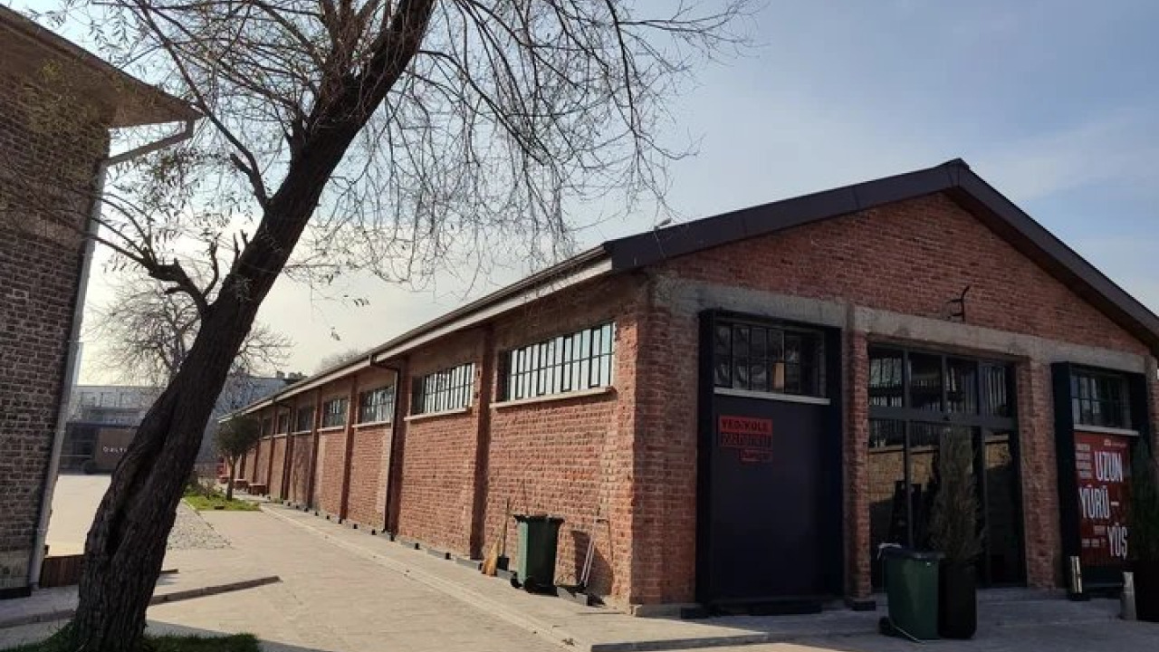
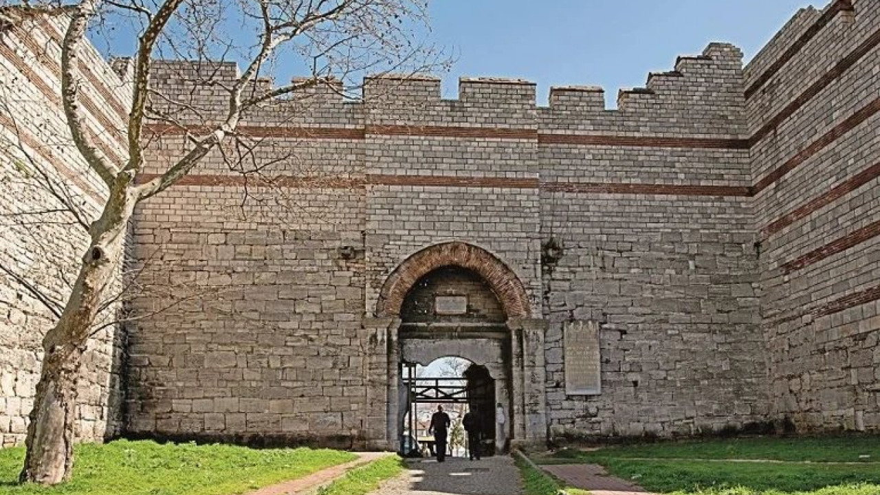
The section between Yedikule and Topkapı is where the Walls are most comprehensively visible; the double walls, the terrace in between, and the remnants of the moat all come into view here. The Istanbul Metropolitan Municipality's restoration efforts have focused heavily on this section: the first phase, including the opening of the Mevlanakapı City Walls Visitor Center, was completed in September 2022, and the Belgradkapı section reopened for walking in February 2024 after its second phase of restoration. The visitor center was established by renovating an abandoned 19th-century building and designed as an information point explaining the city's defense system. However, reports of neglect around the center emerged after its opening, so it's advisable to confirm if it's open on your visit day before heading out. The Fatih Municipality's "Karasurları Millet Bahçesi" (City Walls National Garden) project is also progressing in stages along the same route. This green corridor, extending between Topkapı and Yedikule, encompasses areas around gates like Mevlanakapı and Silivrikapı, forming the walking path.
Topkapı and Edirnekapı: Two Rail Intersections on the Route
These two gates in the middle of the route are also stops for two different tram lines, making them ideal entry and exit points for those wishing to shorten or extend their walk. The Topkapı stop on the T1 Kabataş-Bağcılar line serves the southern stage, while the Edirnekapı stop on the T4 Topkapı-Mescid-i Selam line is used to conclude the northern stage. As its name suggests, the T4 starts from Topkapı and reaches Edirnekapı after the Fetihkapı and Vatan stops. Kariye, just inside Edirnekapı, has been serving as a mosque since 2024 and is closed to tourist visits on Fridays. Its mosaics and frescoes are a subject for another article, not this walking tour.
Northern End: Where the Wall's Character Transforms
As you walk north along the route, the wall you're following is no longer the Theodosian Wall. Knowing this will make the last half-hour of your journey feel entirely different. Tekfur Sarayı (Palace of the Porphyrogenitus) is the surviving fragment of the palace complex in the Blakhernai region and was opened as a museum by the Istanbul Metropolitan Municipality in 2019. From here, the Walls diverge from the original Theodosian line, transitioning to a section added during the Manuel Komnenos period, and gradually descend towards Ayvansaray. Ayvansaray is the area where the land walls meet the Golden Horn (Haliç). The origin of its name is debated; one theory links it to a passage opened in the Golden Horn walls attributed to Eyyûb Ensârî, but this explanation is not definitively confirmed in historical sources. Ending your walk with this knowledge transforms the route from a mere straight wall into a construction process spanning centuries.
| Stage | Gate to Gate | Walk Time | Connection |
|---|---|---|---|
| 1 | Yedikule, Belgradkapı | Approx. 15 minutes | T6 Yedikule station |
| 2 | Belgradkapı, Silivrikapı | Approx. 15 minutes | Silivrikapı section of the National Garden |
| 3 | Silivrikapı, Mevlanakapı | Approx. 20 minutes | City Walls Visitor Center |
| 4 | Mevlanakapı, Topkapı | Approx. 25 minutes | T1 Topkapı stop |
| 5 | Topkapı, Edirnekapı | Approx. 25 minutes | T4 Edirnekapı stop |
| 6 | Edirnekapı, Ayvansaray | Approx. 25 minutes | Şehir Hatları (City Lines) Ayvansaray Pier |
These times do not include breaks and are calculated for a leisurely pace of four kilometers per hour, totaling approximately two hours. This duration is slightly longer than what the official 6,650-meter Wall line would suggest, as walking at street level with road crossings and garden entrances increases the actual distance covered to about eight kilometers.
For those wishing to explore the Byzantine layers with a guide on the same day, programs on the Istanbul City Center cultural tours page offer an alternative itinerary to this walk.
How to Get to the City Walls and Plan Your Route
The most practical starting point is the Yedikule station on the Sirkeci-Kazlıçeşme (T6) rail system line; from there, you can reach the base of the Walls in a few minutes and begin your walk heading north. Here are the steps:
- Start from the South: Take the Sirkeci-Kazlıçeşme (T6) line to Yedikule station, then turn north, keeping the Wall line on your left.
- Complete the First Section: Continue along Belgradkapı and Silivrikapı; in this section, the double walls are visible, and the remnants of the moat can be seen along the way.
- Pause at Mevlanakapı: If the visitor center is open, check out the defense system diagram and adjust the remaining stages of your walk accordingly, either shortening or extending it.
- Decide at Topkapı: If you wish to end your day here, take the T1 tram. If you're continuing, cross Millet Caddesi and enter the northern stage.
- Ascend to Edirnekapı: Tekfur Sarayı stands just north of this gate, adjacent to the Wall. The T4 tram allows you to interrupt your walk at this point.
- Descend to Ayvansaray: After passing Tekfur Sarayı, the Walls gradually descend towards the Golden Horn (Haliç). You can end your day at the pier and catch a ferry.
What's Open and What's Visible from Outside on the Wall Route
To avoid wasting time at closed gates, it's helpful to know upfront which parts of the route are freely accessible and which require tickets. The Wall line itself is an open-air area; ticketed points are few and operate according to their own visiting hours.
| Point | Operated by | Visit Note (Verify) |
|---|---|---|
| Wall line and gates | Open-air area | Freely observed from street level |
| Yedikule Hisarı (Fortress) | Part of the Ministry's Fortresses Museum; restoration by Fatih Municipality | Closed on Mondays; visits operate via guided sessions and reservations |
| Mevlanakapı Visitor Center | Istanbul Metropolitan Municipality | Information point on the Wall line; confirm if open before visiting |
| Tekfur Sarayı Museum | Istanbul Metropolitan Municipality | At Edirnekapı; open to visitors since 2019 |
| Kariye | Serves as a mosque | Closed for tourist visits on Fridays |
Tips to make your walk easier:
- Choose sturdy, comfortable shoes; the route features consecutive sections of dirt, rubble, and unpaved paths.
- Carry water and a hat; there isn't a continuous line of shade-providing trees along the Walls.
- At ticketed points, fee schedules vary by visitor type, so budget for fortress and museum entrances and check the current prices on the operator's website.
- As restoration stages progress alternately along the route, a section might be closed; check for current status before you set out.
- If you prefer to visit the museums inside the Walls on a separate day, the article Historical Peninsula and Museums Guide compiles the stops within the Wall's interior.
Best Season and Time of Day for This Route
Since the walk is entirely outdoors, choosing the right season is more about endurance than comfort. Spring and autumn make the two-hour walk pleasant, while mid-summer necessitates careful timing. The table below breaks down the periods specifically for this route.
| Period | Walking Advantage | Specific Note for the Wall Route |
|---|---|---|
| April-June | Temperatures suitable for walking, long daylight hours | Lush greenery, moat line clearly visible |
| July-August | Early mornings are cool | Little shade, avoid the northern stage during midday |
| September-October | Light softens the stone texture | Evenings get dark early, so start the route before noon |
| November-March | Crowds thin out, pace is more relaxed | Dirt sections become muddy after rain |
Regarding timing, the first three hours of the morning offer both coolness and side lighting, which beautifully highlights the stone courses of the Wall. In the afternoon, the route towards the north remains largely unshaded.
Ending at Ayvansaray: Descending to the Golden Horn Shore
The practical benefit of ending your route at Ayvansaray is the ability to conclude your walk directly on the shore and catch a ferry. The Şehir Hatları (City Lines) Golden Horn (Haliç) ferry line stops at Ayvansaray Pier, offering a natural transition from your land-based walk to a sea journey. As you continue along the Golden Horn from the pier, coastal neighborhoods unfold one after another, providing an extension of your walk for those wishing to prolong their day. Those considering adding a few more stops along the same shore after completing the Wall route can incorporate the coastal-and-hillside itinerary from the Balat Places to Visit Guide article as a continuation of this route.
Two frequently requested stops that fall outside this route are Aya İrini and the Topkapı Palace's First Courtyard. These are part of the palace complex at the tip of the peninsula, not the Wall line, and are subjects for a separate article. Zeyrek Camii (Mosque) is also not on the Walls but on the inner slope overlooking the Golden Horn, in the Zeyrek region, which UNESCO has designated as a separate protected area.
Summing Up Your City Walls Journey
Exploring Istanbul's City Walls is less about chasing a list of stops and more about making strategic decisions along a historical line. When you choose your entry point, your exit gate, and where you'll end your day, the six-gate route comfortably fits into half a day. Starting at Yedikule and finishing at Ayvansaray aligns both your transportation logistics and the historical narrative in a coherent direction.
Frequently Asked Questions 5
How long are Istanbul's City Walls and how long does it take to walk them?
The Theodosian Land Walls are officially recorded by UNESCO as 6,650 meters long. However, walking at street level, with road crossings and garden entrances, increases the actual distance covered to approximately eight kilometers. At a non-stop pace, this takes about two hours, or half a day with stops.
How do I get to Istanbul's City Walls by public transport?
At the southern end, use the Yedikule station on the Sirkeci-Kazlıçeşme rail system line. In the middle of the route, the Topkapı stop of the T1 Kabataş-Bağcılar tram and the Edirnekapı stop of the T4 Topkapı-Mescid-i Selam tram are convenient. At the northern end, the Şehir Hatları (City Lines) Golden Horn (Haliç) ferry line stops at Ayvansaray Pier.
Is there an entrance fee to visit the City Walls?
The Wall line itself is an open-air area and can be freely observed from street level. Fees only apply at ticketed points like Yedikule Hisarı (Fortress) and Tekfur Sarayı Museum. Since these places often have different rates based on visitor type, it's best to check the current prices on the respective operator's website.
When and by whom were the City Walls built?
The Walls, which encircle the Historical Peninsula from the west, were built at the beginning of the 5th century during the reign of Emperor Theodosius II. According to UNESCO records, the second defensive line was added in 447 AD, and the structure is considered a primary reference for military architecture.
Which gates are passed in order along the City Walls route?
Walking from the Marmara Sea towards the Golden Horn (Haliç), the gates are encountered in this order: Yedikule, Belgradkapı, Silivrikapı, Mevlanakapı, Topkapı, and Edirnekapı. After Edirnekapı, the route passes around Tekfur Sarayı and descends to the Golden Horn shore at Ayvansaray.