
A walking route in Heybeliada typically begins at the pier square, traces a line from Ümit Tepesi in the northwest to Değirmentepe, the island's highest point, descends to Değirmenburnu cove on the western shore, and returns to the pier via the coastal path. According to the Adalar Municipality, the island measures approximately 2,700 × 1,200 meters and features four distinct hills. This scale allows a half-day walk to encompass both forest trails and the coastline. With no motorized vehicle traffic on the island, the predominant sounds along the route are usually the wind and the sea, which often leads to longer, more contemplative breaks at scenic viewpoints.
Quick Facts
| Topic | Information |
|---|---|
| Location | Istanbul, Adalar district; the second largest of the Princes' Islands after Büyükada |
| Island Size | Approximately 2,700 × 1,200 meters (Adalar Municipality data) |
| Hills | Four hills; highest point Değirmentepe at 136 meters, Ümit Tepesi at 85 meters |
| Sea Access | City Lines (Şehir Hatları) ferries from Kabataş, Bostancı, and Beşiktaş stop at Heybeliada |
| Island Transport | No motorized vehicle traffic; the route is completed on foot |
| Route Character | Continuous uphill climb from the pier, followed by coves and coastal path |
| Suggested Duration | Half-day; varies depending on breaks and photo stops |
| Scenic Viewpoints | Değirmentepe, Ümit Tepesi, Değirmenburnu, Çam Limanı |
What Scenic Spots Can You See in Heybeliada?
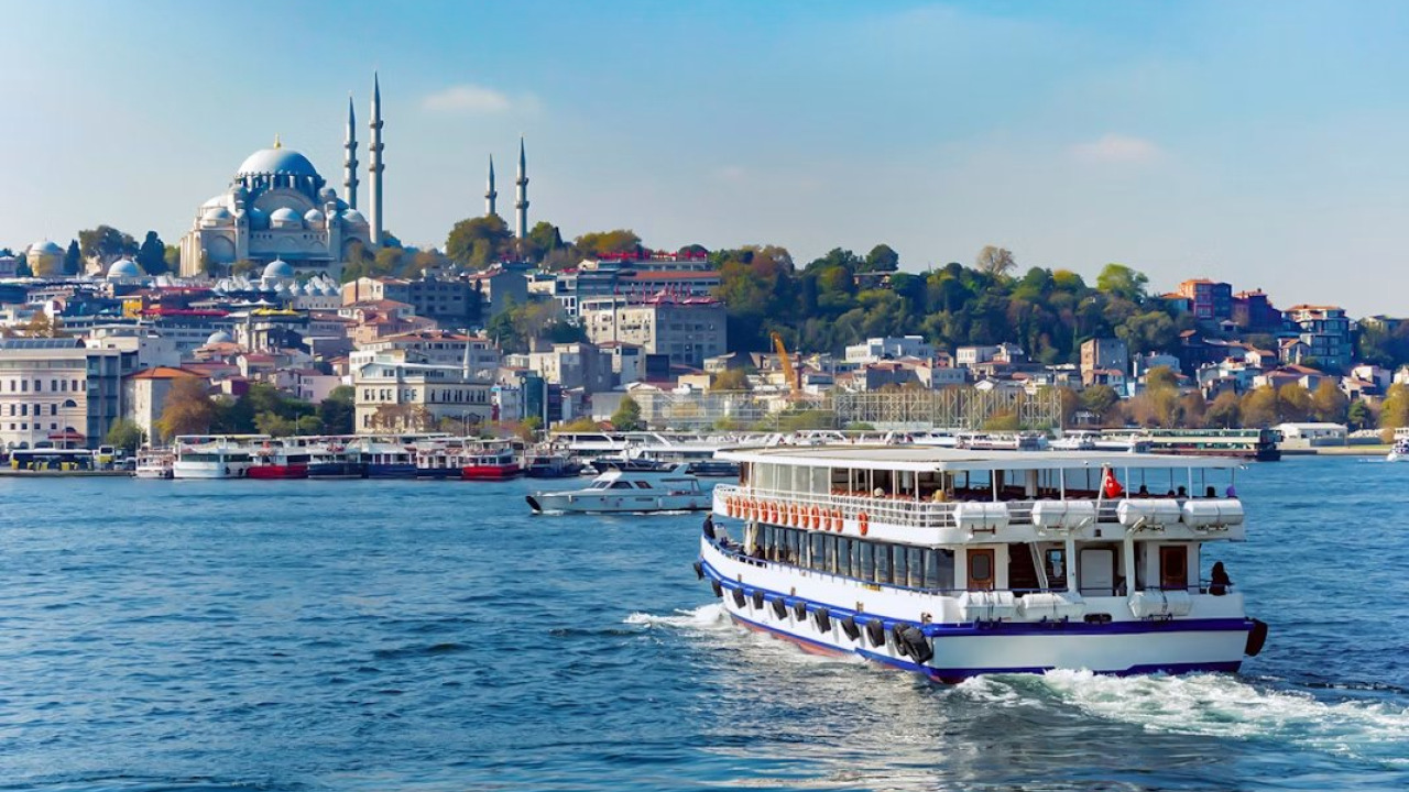
The island's scenic spots are distributed across two hills and two coves: Ümit Tepesi, Değirmentepe, Değirmenburnu on the western shore, and Çam Limanı to the south. These four stops are within walking distance of each other, so they are best visited by elevation rather than popularity: tackle the hills first, then descend to the coves. The island's charm is evident even from the ferry deck: the hills emerging beneath a pine canopy and the wooden mansions lining the shore offer a preview of your route before you even step ashore. For those who wish to make their arrival part of the adventure, you can explore sea routes on our Istanbul boat and ferry tours page. While iconic landmarks like Büyükada's Aya Yorgi Hill and Splendid Palas might capture more attention, Heybeliada's allure stems from the short, picturesque transitions between its hills and coves.
Ümit Tepesi and Heybeliada Seminary
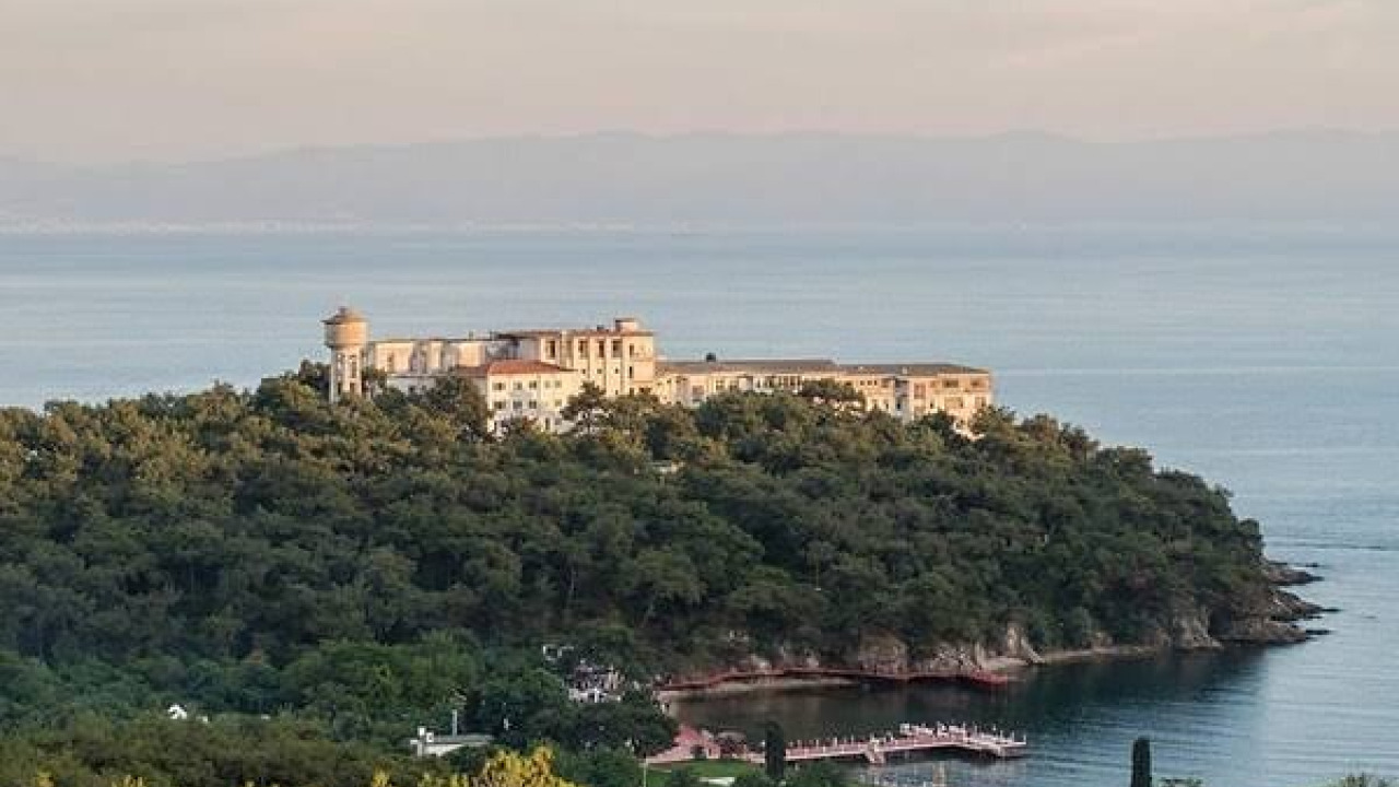
Located in the northwest of the island, Ümit Tepesi stands at 85 meters and was formerly known as Papaz Tepesi (Priest's Hill). The Heybeliada Seminary (Halki Seminary) is situated on this hill. According to the Ecumenical Patriarchate, the Aya Triada Monastery, located on the seminary grounds, dates back to the Byzantine era. Patriarch Germanos IV visited the monastery in 1842, and on October 1, 1844, both the monastery and the theological school were reactivated with a ceremony. The Ecumenical Patriarchate states that the school closed in 1971 following regulations restricting private higher education institutions. Today, the building does not operate as a freely accessible museum: access to the interior and library requires permission from the Patriarchate, and the building is primarily used for meetings and seminar programs. As its restoration and reopening are currently under discussion, the situation may change; check for current announcements before your visit. From a hiking perspective, this section of the route is shaded, with a continuous pine canopy along the path leading up the hill, opening up to the northwest horizon at the garden wall.
Değirmentepe: The Island's 136-Meter Summit
Değirmentepe, at 136 meters, is the highest point on the island. Along with Taşocağı Hill and Makarios Hill, it completes the island's four elevations. The summit offers panoramic views of the Marmara Sea and neighboring islands simultaneously; Burgazada and Kınalıada appear one after another to the west, just as they do on the ferry's route. The steepest part of the route is the final ascent to this peak, so timing your climb for the cooler morning hours will make the hike easier. Practical tip: Shade is scarce at the summit, so ensure you have enough water before heading up.
Değirmenburnu: Western Shore Cove and Picnic Area
Değirmenburnu, on the island's west, is a sheltered cove protected from northern winds and marks the descent of the route to sea level. The picnic and viewing area, operated by the Adalar Municipality, was established in 1981. With a capacity for approximately 4,000 people, it features an entrance control booth, a country restaurant, a buffet, water facilities, viewing platforms, picnic units, benches, and rain shelters. For hikers, the real value here is the infrastructure rather than just the view: after a long climb, water, shade, and a place to rest are all conveniently located in one spot. As the area's seasonal and hourly regulations are determined by the municipality, it's advisable to check current announcements before your visit.
Çam Limanı and the Sanatorium Slope
Among the island's four ports, Çam Limanı and Bahriye Limanı stand out. The Adalar Municipality promotes Çam Limanı as a natural marina-like cove and picnic area. The path leading down to the cove passes through the densest part of the pine forest, ensuring it remains cool even in mid-summer. On the same slope stands a building established in 1924, known as Turkey's first sanatorium. The building has not provided health services for a long time and its interior is not open to visitors; it can only be seen from the outside during your walk. Planning with the expectation of closed doors will prevent wasted time on this slope.
Pier Square and Northern Coastline
The route both begins and ends at the pier square. Walking from the square along the northern coast, you'll pass the Heybeliada campus of the Naval Academy. This is a military area, not open for public visits, and visitors are expected to adhere to signage regarding photography. The wooden mansions lining the coast showcase the island's residential fabric that grew during the period of regular ferry services. The Adalar Municipality also lists the Aya Ofemya Holy Spring among the island's significant structures. The table below summarizes the visit status of the stops along the route.
| Stop | What's there | Visit Status (confirm before departure) |
|---|---|---|
| Heybeliada Seminary | Aya Triada Monastery and the theological school opened in 1844 | Closed for education since 1971; interior access by permission |
| Değirmenburnu | Cove, viewing area, country restaurant, and buffet | Operated by the municipality; seasonal and hourly regulations vary |
| Çam Limanı | Natural cove-like harbor and picnic area | Coastal section open to walking routes |
| Sanatorium Building | Sanatorium building established in 1924 | Out of service; visible from outside, no interior visits |
| Naval Academy Campus | Military campus on the northern coast | Closed to public visits |

Which Piers Offer Ferries to Heybeliada?
Three different City Lines (Şehir Hatları) routes stop at Heybeliada: the island line departing from Kabataş, the circular line from Bostancı, and the line between the Islands and Beşiktaş. On all three, Heybeliada is the third island stop after Kınalıada and Burgazada, meaning the order of islands remains the same regardless of your departure pier.
European Side: Kabataş and Beşiktaş Departures
The line departing from Kabataş stops sequentially at Kabataş, Eminönü, Kadıköy, Kınalıada, Burgazada, Heybeliada, Büyükada, and Bostancı piers; thus, passengers boarding from the European side also connect to the Anatolian side. According to the City Lines' published schedule, services on the Islands-Beşiktaş line run between 07:00 and 22:25 on weekdays and Saturdays, and between 10:20 and 22:25 on Sundays and public holidays. This time frame is crucial for those planning a walking itinerary: arriving early on the island allows you to reach the hills before the hottest hours.
Anatolian Side: Bostancı and Kadıköy Connections
The circular line departing from Bostancı follows the sequence of Bostancı, Kınalıada, Burgazada, Heybeliada, and Büyükada, returning to the same pier. Since the circular route stops at all intermediate piers, the total duration varies by service and day type, so it's essential to check the departure times from the City Lines' current schedule. Kadıköy serves as both a stop on the Kabataş line and a return stop on the Beşiktaş line, providing two distinct connection points on the Anatolian side.
| Departure Pier | Line | Notes |
|---|---|---|
| Kabataş | Kabataş - Islands | Also stops at Eminönü and Kadıköy, continues to Büyükada and Bostancı |
| Bostancı | Bostancı - Islands Loop | Stops at all intermediate piers; departure time and duration confirmed from schedule |
| Beşiktaş | Islands - Beşiktaş | Weekdays & Saturdays 07:00-22:25, Sundays & holidays 10:20-22:25 |
Tickets are paid with Istanbulkart. City Lines announces that fares double between 00:30 and 05:30 on routes with night tariffs; discount and refund conditions on island lines also differ from other routes. For those connecting their walk to an evening ferry, this detail directly impacts the budget, so it's wise to confirm the current fare from the official source. If you're curious about the character of the islands relative to each other, our Princes' Islands travel and transport guide offers a comparison of the four islands. For those who prefer to admire from the deck rather than climb hills, Heybeliada boat tour options offer a sea-level perspective of the same coastline: Değirmenburnu and Çam Limanı coves unfold from an angle not visible from land.
Which Season and Time Slot are Best for Walking?
For this uphill-heavy route, the cooler hours are more critical than the season itself: even in mid-summer, it's possible to reach the hills early in the morning, whereas the Değirmentepe section can be challenging under the midday sun. The table below illustrates how the same four-stop route changes throughout the year.
| Period | Walking Conditions | Specific Notes for Heybeliada |
|---|---|---|
| April-June | Cool climbs, long daylight hours | Pine shade extends up to the hills, making the ascent comfortable |
| July-August | Suitable early morning and late afternoon | Shade decreases at the summit, water resupply from the center |
| September-October | Softer light, fewer crowds | Cove areas become quieter, easier to find a resting spot |
| November-March | Island is quiet, streets are empty | Sloping paths can be slippery when wet, confirm return ferry times in advance |
Ferry schedules are updated seasonally, so winter service frequency may differ from summer arrangements. The month-by-month variation in island choice is a topic for a separate article; here, the criterion is solely walking comfort.
Food, Drink, and Water Supply Along the Route
Food and drink options are concentrated around the pier square and the coastline; as you ascend to the hills and forest paths, the number of establishments decreases. The country restaurant and buffet at Değirmenburnu are operational stops on the descent to the western coast, but their operating hours may change outside of peak season. Therefore, it's advisable to stock up on water and light snacks around the pier to maintain the flow of your route. Those curious about the island's culinary place within Istanbul's broader food scene can refer to the fish and meze sections in our Istanbul cuisine guide.
Items to consider when planning your budget include the following; as amounts vary by season and establishment, no specific figures are given here, please check official sources for current prices:
- Sea transport: Round-trip ferry ticket, with different fares for night tariffs on return journeys.
- Water and snacks: Best purchased at the start, as establishments are sparse at higher elevations.
- Lunch break: Coastal establishments and the country restaurant by the cove operate on different price scales.
- Island transport: Electric vehicle options are a separate cost for those who prefer not to walk.
Step-by-Step Walking Route Starting from the Pier
Opening the route with an uphill climb and closing with the coastline prevents tackling steep sections with tired legs. The following sequence starts and ends at Heybeliada pier:
- Walk from the pier square to the northern coast: The coastal path along the Naval Academy campus is a warm-up stage, with a flat surface.
- Turn towards Ümit Tepesi: The path from here is continuously sloped; the 85-meter hill where Heybeliada Seminary is located is the first scenic stop on the route.
- Follow the ridge line up to Değirmentepe: The 136-meter summit is the island's highest point, offering views of the Marmara Sea and neighboring islands.
- Descend the western slope to Değirmenburnu: The pine canopy continues throughout the descent, and the viewing and picnic area in the cove is suitable for a long break.
- Proceed along the southern coast to Çam Limanı: The sanatorium building is visible from the outside on this slope, and the cove area is shaded.
- Return to the pier via the coastal path: This final, flat section passes in front of wooden mansions and provides a time buffer for your return ferry.
The entire route, at a normal pace, fits into a half-day program; fitness level, number of breaks, and photo time significantly alter the total duration. Those wishing to shorten the stages can skip the summit and content themselves with the pier, Ümit Tepesi, and coastal path.
Practical Notes Before Your Walk
What to Bring
- Sturdy walking shoes: A large part of the route is sloped and sometimes unpaved.
- Sufficient water: Fountains and establishments are sparse at higher elevations.
- Hat and sunglasses: Shade decreases at the summit.
- Light windbreaker: The wind at the top is stronger than on the coast.
- Offline map: Helps with navigation at path junctions.
Terrain, Slope, and Island Rules
There is no motorized vehicle traffic on the island; following a decision by Istanbul Metropolitan Municipality in 2020, horse-drawn carriages were removed and replaced with electric vehicles for public transport. This arrangement benefits walkers, but you'll need to yield to electric vehicles and bicycles on narrow paths. Families with small children might prefer the coastal path and pier area, omitting the summit stage from their itinerary. Most mansions are private property, so it's best to photograph their facades from a distance without attempting to open garden gates. For those looking to integrate the island into a broader city program, Istanbul tours offer various options.
To Summarize the Route
A walk in Heybeliada is structured as a half-day route, starting from the pier, ascending to Ümit Tepesi and Değirmentepe, then descending to the coves of Değirmenburnu and Çam Limanı. If you account for potentially closed sites, stock up on water at the center, and note your return ferry schedule, the island transforms from a collection of scattered stops into a cohesive and enjoyable journey.
Frequently Asked Questions 5
How long does the Heybeliada walking route take?
The route, starting from the pier and covering Ümit Tepesi, Değirmentepe, Değirmenburnu, and the coastline, typically takes a half-day at a normal pace. The duration varies depending on fitness, number of breaks, and time spent at scenic viewpoints. The route shortens significantly if the summit stage is omitted.
Which piers offer ferries to Heybeliada?
City Lines (Şehir Hatları) ferries from Kabataş (island line), Bostancı (circular line), and the line between the Islands and Beşiktaş all stop at Heybeliada. The Kabataş line also stops at Eminönü and Kadıköy, providing connections from both European and Anatolian sides. For current schedules, please check the official City Lines timetable.
Can Heybeliada Seminary be visited?
The school has been closed for education since 1971 and does not operate as a freely accessible museum; according to the Ecumenical Patriarchate, access to the interior and library requires permission from the Patriarchate, and the building is primarily used for meetings and seminar programs. As its restoration and reopening are currently under discussion, the situation may change, so check for current announcements before your visit.
What is the highest hill in Heybeliada?
According to the Adalar Municipality, the highest point on the island is Değirmentepe, at 136 meters. Other elevations include Taşocağı Hill, Makarios Hill, and Ümit Tepesi, which is 85 meters high; Heybeliada Seminary is located on Ümit Tepesi.
What should I bring for a Heybeliada walk?
Sturdy walking shoes, sufficient water, a hat, a light windbreaker, and an offline map are enough for the route. As establishments are sparse at higher elevations, it is recommended to stock up on water and snacks around the pier.