The walking routes and visitor guidelines for Göbeklitepe cover the visitor welcome center-to-olive grove pedestrian path on the ridges of Örencik Village in the Haliliye district of Şanlıurfa, the circular wooden walking platform surrounding the A, B, C, and D temple enclosures, the Dilek Ağacı hilltop, and the Neolithic limestone quarry trails. To explore these pedestrian paths as they wind through the windy steppe ridges overlooking the Harran Plain within Turkey's "Taş Tepeler" archaeological zone, you can view professional guided field programs via our Göbeklitepe walking tour options.
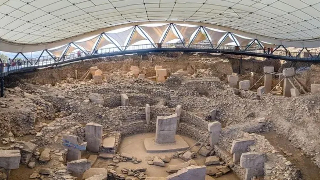
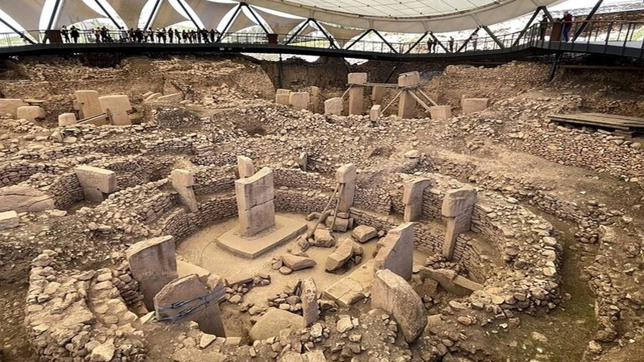
The Göbeklitepe ridge, part of the Germuş Mountains rising northeast of Şanlıurfa city center, is designed for pedestrian circulation with no vehicle traffic allowed. After exiting the immersive simulation galleries in the welcome building, visitors can ascend to the main mound either via electric shuttle vehicles or by taking the stone-bordered walking path that winds through ancient olive trees. While the wooden walkway under the steel membrane protective roof allows you to circle the T-shaped pillars from above, the steppe paths outside the roof extend toward the ancient stone quarries and the Karahantepe walking axis.
The following summary outlines the key features of the pedestrian routes within the Şanlıurfa Göbeklitepe archaeological site and the wider Taş Tepeler line:
- The olive grove path between the visitor center and the excavation roof offers a gentle uphill warm-up walk with stunning views of the Harran Plain.
- The circular wooden platform under the protective roof allows for a clockwise stroll around the A, B, C, and D structural layers on a non-slip, railed surface.
- The Dilek Ağacı (the iconic mulberry tree) ridge at the summit and the Neolithic stone quarries on the western slope are the primary exploration stages for those seeking open-terrain steppe hiking.
- Since there is no tree shade on the open limestone plateau, it is vital to plan your walk for the early morning or the cooler period near sunset.
Quick Guide to Göbeklitepe Walking Trails
The walking layout at the Şanlıurfa Göbeklitepe archaeological site consists of four consecutive pedestrian stages: the enclosed simulation corridor, the olive grove slope, the under-roof wooden walkway, and the outer ridge stone quarry path. When walking these stages in the Southeast Anatolian steppe climate, careful planning regarding terrain and timing is essential.
The table below summarizes the location, terrain, duration, and active tour information for the Göbeklitepe walking trails:
| Criteria | Field & Walking Information |
|---|---|
| Geographic Location & Ridge Line | Turkey, Şanlıurfa, Haliliye, Örencik Village (Northeast limestone plateau) |
| Pedestrian Stages | Welcome Center-Olive Grove Path, Wooden Roof Platform, Dilek Ağacı & Stone Quarries |
| Terrain & Incline | Indoor flat ground, stone-bordered slope on the mound path, wooden platform under roof, limestone rock on the ridge |
| Active Program Inventory | 3 live products under Göbeklitepe Walking Tours and the Taş Tepeler cultural walk |
| Sample Field Walking Duration | 3-hour field excursion as part of the 3-Day Nemrut Dağı, Göbeklitepe, and Karahantepe Tour from Şanlıurfa |
| Pre-Information Stage | Visual storytelling in the visitor welcome center simulation and animation halls |
To preserve the archaeological integrity, pedestrian flow at the site is restricted to designated walking belts. The three live products listed in our Göbeklitepe Walking Tours allow travelers to explore both the on-site wooden platforms and the surrounding Taş Tepeler stops accompanied by expert guides.
Göbeklitepe On-Site and Surrounding Ridge Walking Routes
Walking in Göbeklitepe follows a marked route that begins in the animation halls after the ticket office and connects the circular temple structures on the hilltop with the open limestone beds. Each stage offers a different terrain character and perspective.
The Welcome Center and Olive Grove Ascent
The first stage of the walk begins with exploring the archaeological presentations and animation galleries at the visitor welcome center; these 3D digital experience areas prepare visitors for the belief systems and architectural world of the Neolithic era. After exiting the building, the stone-paved pedestrian path leads toward the mound, rising at a gentle incline through groves of young olive trees. Those who choose to walk this path instead of using service vehicles can observe step-by-step how the steppe topography rises from the plain.
The Wooden Platform Surrounding Structures A, B, C, and D
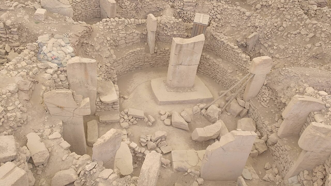
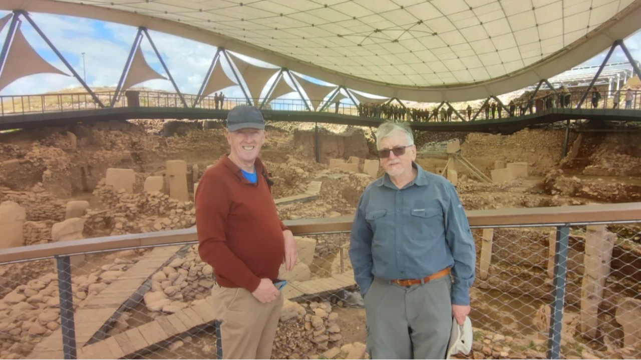
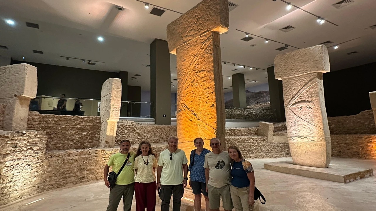
Upon reaching the mound area, walkers step onto the wide wooden walking platform located beneath the steel membrane protective roof. This circular walkway, featuring non-slip wooden flooring and glass-metal railings, passes directly over the excavation pits, offering a bird's-eye view of the A, B, C, and D temples. As you walk along the platform, you can examine the high-relief carvings of lions, bulls, foxes, cranes, scorpions, and wild boars, as well as H-shaped symbols, all accompanied by informative display panels.
Dilek Ağacı Hilltop and the Neolithic Stone Quarry Ridge Path
Exiting the upper level of the wooden platform brings you to the open observation terrace at the summit, home to the ancient mulberry tree (Dilek Ağacı). From here, you can enjoy panoramic views of the Harran Plain to the south and the Germuş Mountains to the north. For those wishing to continue their walk on natural steppe ground, the outer walking line extends to the limestone rocks on the western and northwestern slopes of the mound. Here, you can see the T-shaped pillar drafts (the ancient stone quarries) that were left unfinished before being detached from the bedrock.
Travelers wishing to walk while listening to the archaeological context of the pillar carving channels and temple architecture can explore licensed guided programs via our Göbeklitepe guided tour options.
Comparison Table: Göbeklitepe and Taş Tepeler Walking Stages
The Neolithic walking routes in Şanlıurfa range in difficulty, from the flat wooden platforms within the site to the rocky paths of Karahantepe and Soğmatar in the eastern steppe belt. Participants should choose their footwear and walking duration based on these stage differences.
The following table compares the Göbeklitepe and connected Taş Tepeler walking stages by terrain, incline, and observation elements:
| Walking Stage | Terrain Type | Incline & Difficulty | Key Sights During Walk | Recommended Profile |
|---|---|---|---|---|
| Welcome Center & Olive Grove Path | Indoor flat ground and stone-paved ramp | Gentle ascent, easy pace | Digital animation halls and olive grove corridor | All visitors and families |
| Under-Roof Circular Wooden Platform | Railed, non-slip wooden walkway | Stepped and flat transitions, easy | A, B, C, D temples and T-shaped pillars | Cultural travelers of all ages |
| Dilek Ağacı & Stone Quarry Ridge | Natural limestone rock and dirt path | Slightly undulating open ridge, moderate pace | Unfinished stone quarries and Harran Plain views | Outdoor enthusiasts and photographers |
| Karahantepe (Keçilitepe) Stage | Limestone rocky plateau and surrounding trail | Moderate incline steppe terrain | Pit structures and pillars carved into bedrock | Archaeology and hiking enthusiasts |
| Balıklıgöl - Urfa Castle City Line | Historic cut-stone streets and courtyard ground | Flat plain and castle slope steps | Halil-ür Rahman Lake, historic inns, and bazaars | Culture and urban walking lovers |
By combining these stages, a balanced day plan for heat management involves walking the Göbeklitepe and stone quarry ridge in the early morning, then moving to the Karahantepe or city center walking lines in the afternoon.
Göbeklitepe Walking Tours and the Taş Tepeler Connection
Walking and archaeology tours based in Şanlıurfa integrate the Göbeklitepe site walk with Karahantepe, Harran, and the Şanlıurfa Archaeology Museum (Haleplibahçe) into a cohesive itinerary. The three live products offered within our Göbeklitepe Walking Tours meet all local transportation and guiding needs.
Karahantepe and Sefertepe Pedestrian Connection
Archaeology enthusiasts who complete the Göbeklitepe ridge walk can proceed to the Karahantepe site on the eastern Keçilitepe ridges to walk the pedestrian circuit surrounding the rock-cut pit structures and pillar arrangements. Specifically, in our 3-Day Nemrut Dağı, Göbeklitepe, and Karahantepe Tour starting from Şanlıurfa, the 3 hours allocated for the Göbeklitepe field walk allows for a relaxed exploration of the welcome center, the roof platform, and the Dilek Ağacı ridge.
Balıklıgöl Plateau and Historic Urfa Streets Walk
After the Neolithic site walk on the steppe ridges, those wishing to explore the historic cut-stone streets of Şanlıurfa, the Gümrük Hanı courtyard, Sipahi Pazarı, and the Balıklıgöl plateau on foot can review the routes on our Göbeklitepe historic city tour options page.
Visitor Notes and Field Rules for Walking Göbeklitepe
Specific field rules are enforced on the Göbeklitepe limestone ridge to both protect the Neolithic excavation site and ensure visitor adaptation to the harsh sun and wind of Southeast Anatolia. Descending into the excavation pits or climbing over railings is strictly prohibited.
The following five-step field protocol outlines the recommended sequence for visitors planning a walk at Göbeklitepe:
- To avoid the midday sun on the open limestone ridge, plan your walk for the early morning opening hours or the late afternoon before sunset.
- Begin your walk in the chronological exhibition and simulation rooms at the welcome center to learn the meanings of the animal symbols on the pillars.
- Wear lightweight walking shoes with non-slip soles and ankle support for the rough limestone terrain on the olive grove slope and stone quarry ridge.
- Follow the clockwise pedestrian flow on the wooden platform under the roof; take care not to obstruct the walkway while taking photographs.
- While walking the Dilek Ağacı hilltop and the outer stone quarry path, carry drinking water, sunglasses, and a wide-brimmed, wind-resistant hat in your bag.
Recommended equipment for your field walk includes:
- Comfortable walking shoes with good grip for both the wooden platform and natural limestone rocks.
- UV-filtered sunglasses, high-factor sunscreen, and a hat to protect against the steppe sun.
- A lightweight windbreaker for the steppe winds that can be quite strong on the ridge during spring and autumn.
- A compact pair of binoculars or a camera with a zoom lens to clearly see the reliefs at the bottom of the excavation pits from the platform.
For those wishing to visit the Neolithic sites in the region with full-day transportation and guiding included, program details can be compared via our Göbeklitepe day culture tour options.
General Assessment of Şanlıurfa Göbeklitepe Walking Plans
A field plan prepared in accordance with the Göbeklitepe walking routes and visitor notes offers a holistic experience ranging from the Neolithic temples on the Örencik ridge to the stone quarries and Karahantepe plateaus. To add district and city walks to your trip, you can review the programs in our Göbeklitepe city tour options list and create your walking itinerary based on the season.
Frequently Asked Questions 1
Where is Göbeklitepe located?
Göbeklitepe is situated on a high limestone ridge in the extension of the Germuş Mountains, near Örencik Village within the Haliliye district of Şanlıurfa province in Turkey's Southeast Anatolia Region. This panoramic hilltop, overlooking the Harran Plain to the south and the Karahantepe plateaus to the east, is located on the northeast axis of Şanlıurfa city center.