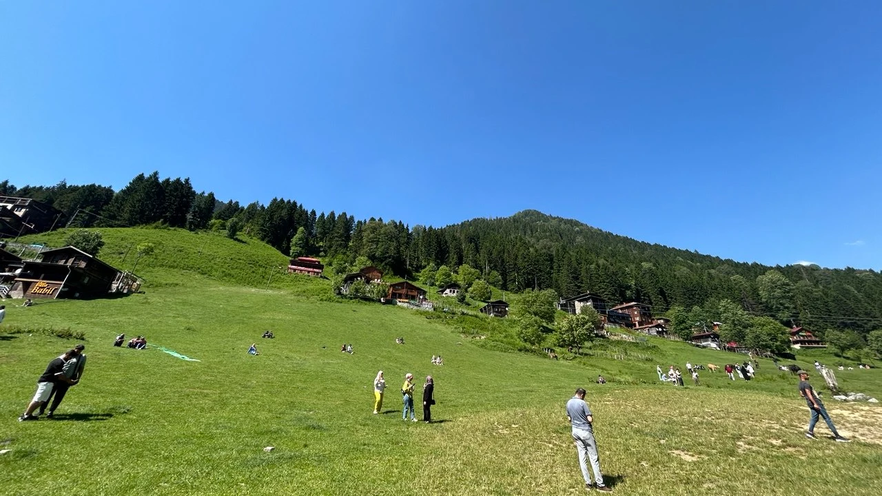
Hiking routes in Ayder range from gentle strolls through the plateau to challenging treks ascending the upper reaches of the Fırtına Valley and surrounding highlands. Depending on the trail type and your itinerary, durations vary significantly. For professional guidance, explore our Ayder hiking tours page; this guide will help you choose the right route, plan your timing, and prepare for the journey.
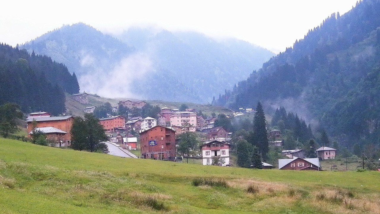
Ayder, located in the Çamlıhemşin district of Rize, serves as the premier gateway to the breathtaking Kaçkar Mountains. The trails wind through lush forests, open up into sweeping alpine meadows, and are subject to rapid weather shifts. Because of this, choosing your route, estimating the time, and packing the right gear must be done in tandem. The following sections break down these decisions and explain how to join a guided expedition.
Highlights
- Routes vary from short local walks to multi-day Kaçkar mountain crossings.
- Timing is based on elevation gain and terrain; always leave a buffer for weather changes.
- For guided tours, specific routes, gear lists, and departure times are detailed on the tour page.
- The journey from Çamlıhemşin to Ayder is a scenic 19 km mountain road, which can slow down during rainfall.
Quick Facts
Ayder hikes are generally categorized as either day trips or multi-day expeditions. The terrain transitions from forest paths to rocky plateau trails, and the weather can shift dramatically within hours. Timing depends on the altitude gain and your planned return; for guided tours, these details are pre-arranged. The table below summarizes these variables.
| Category | Details |
|---|---|
| Location | Rize, Çamlıhemşin district, upper Fırtına Valley |
| Route Types | Local plateau walks, neighboring highland crossings, high-altitude Kaçkar routes |
| Duration | Day trips (1 day); High-altitude routes (3+ days with camping) |
| Terrain | Forest trails, stony plateau paths, rocky terrain, and stream crossings |
| Best Season | From the snowmelt until the first snowfall; summer is peak season |
| Participation | Independent hiking or guided tours (gear lists provided for guided options) |
| Nearest Hub | Çamlıhemşin, approx. 19 km via mountain road |
The values in this table serve as a starting point; actual plans should be updated daily based on weather reports and the group's pace. To ensure accuracy, specific distance and altitude figures are kept to verified sources only.
How to Choose Your Ayder Hiking Route
Selecting the right trail comes down to three questions: how many days do you have, what is your group's fitness level, and is it a loop or a point-to-point trek? Local walks are half-day affairs, highland crossings take a full day, and high-altitude Kaçkar routes require camping and a professional guide.
Short Local Walks
These routes begin in the heart of Ayder, following the riverside and ascending toward the forest line. The terrain consists mostly of well-maintained paths with minimal elevation gain, usually returning via the same route. These are perfect for families with children, first-time hikers, or those with other plans for the day. Starting early allows you to return before the afternoon mist rolls in.
Neighboring Highland Crossings
These routes lead upward from Ayder to neighboring plateaus such as Huser. The path transitions into stony highland trails, the incline increases, and the hike typically occupies a full day. It is essential to carry plenty of water, extra layers, and a raincoat. Always leave a margin for fading light and fog; if the group's pace is slow, it is better to shorten the route than to push into the night.
High-Altitude Kaçkar Routes
The most challenging treks start in Ayder and lead to high mountain passes and glacial lakes. These are multi-day expeditions involving camping. The terrain includes jagged rocks, moraines, and stream crossings, with weather that can turn volatile in minutes. These routes are strictly for experienced hikers and should only be attempted with a professional guide who possesses local knowledge and emergency protocols. The season opens after the snow melts; early or late visits may find routes blocked by snow.
Routes and Durations: Planning Your Day
Timing depends on the route type, elevation gain, and the pace of the group; the same trail can take significantly longer for a slower group. Day trips are completed within 24 hours, while high-altitude treks require a 3+ day camping plan. The table below matches route types with timing and terrain.
| Route Type | Duration | Terrain & Notes |
|---|---|---|
| Local Plateau Tour | Half-day, return to start | Maintained paths, riverside |
| Highland Crossing | 1 full day, morning start | Stony paths, steep sections |
| High Kaçkar Route | 3+ days, camping | Rocky, stream crossings, guide mandatory |
| Guided Group Tour | As per tour itinerary | Gear list and meeting point provided |
How to Plan a Day Trip
A successful day trip is built in five steps. If the weather changes, revert to step one, shorten the route, and move up your return time.
- Check the forecast; if fog or rain is predicted, stick to a local plateau route.
- Start early in the morning to ensure you have plenty of daylight for the return.
- Pack water, high-energy snacks, extra clothing layers, and a waterproof jacket.
- Set the pace based on the slowest member of the group and identify "turn-back" points.
- Conserve enough energy to reach your accommodation or vehicle safely.
Duration and Lodging for Multi-Day Treks
Multi-day routes break the journey with overnight stays in tents or traditional highland houses. Kaçkar crossings are typically planned for 3 days or more. Daily distances are calculated alongside elevation gain and the time needed to set up camp. Reaching camp by evening is a critical part of the plan. On these routes, the guide manages navigation and emergency plans; groups should never venture out without one. If weather closes in, the plan is extended to wait out the storm rather than ascending.
Essential Participation Notes: Weather, Terrain & Gear
Your decision to hike should be based on the "Trinity" of weather, terrain, and gear. In Ayder, fog and rain can strike mid-day, and paths become slippery when wet. Never set out without proper footwear, a raincoat, and spare layers. These notes apply to both independent hikers and those on guided tours.
Weather and Seasonal Conditions
The hiking season in Ayder opens with the snowmelt and closes with the first snowfall, with summer being the peak period. The East Black Sea climate is humid; a clear morning can turn into a foggy afternoon. Therefore, early departures are key. Always re-check the forecast before leaving. In the event of storm or lightning warnings, high-altitude routes must be postponed in favor of local walks.
Terrain and Footwear
Expect a mix of roots and mud on forest paths, stones and boulders on highland roads, and wet surfaces during stream crossings. Ankle-supporting boots with a high-grip sole are the only viable solution for all three terrains. Trekking poles are highly recommended to protect the knees during descents and provide balance in streams. While sneakers may suffice for a local stroll, they are unsuitable for highland crossings.
Group Dynamics and Pacing
When hiking in a group, the pace is set by the slowest member to ensure no one is left behind. Establish a clear order: a navigator in front and a "sweep" at the back. Agree on break points in advance. Beginners and children should start with local routes before attempting highland crossings the following day. In guided tours, the professional guide manages this organization.
Gear Checklist
The gear list expands based on the route, but the following items are fundamental for every hike:
- Water and salty snacks; natural springs are not available everywhere.
- Raincoat and a wind-breaking outer shell; plus one extra warm layer.
- Map or offline GPS tracks; mobile signal often drops in the valleys.
- Small first-aid kit, headlamp, and sun protection.
- For multi-day routes: Tent, sleeping bag, and stove (guided tours provide a specific list on their page).
For guided tours, the list and meeting point are provided in the itinerary. For independent hikers, the responsibility lies with the participant; missing gear often means a shortened route.
Guided Tour vs. Independent Hiking
A guided tour provides the route, safety plan, and gear list upfront; independent hiking places all planning and responsibility on the participant. While independent walks are fine for short local routes, highland crossings and high-altitude treks necessitate a guide. The choice depends on the difficulty of the trail and your experience level.
What's Included in a Guided Tour?
Guided tours specify the route, meeting point, itinerary, and included services on the tour page. Guided tour options in Ayder allow the pace to be adjusted to the group and the plan to be updated in real-time based on weather. The participant only needs to prepare their personal gear; navigation and timing are handled by the expert.
Tips for Independent Hikers
If hiking solo or independently, establish your route, return time, and a communication plan before departing. Leave your itinerary and expected return time with your hotel or host; if signal is lost in the valley, this note is the starting point for any search effort. For those seeking a slower pace, Ayder village and nature tour options are a great alternative to strenuous hiking. Solo hikers should strictly limit themselves to local plateau routes.
How to Decide?
Compare the route type, your experience, and your available time. If you are an experienced hiker doing a local tour, go independent. If you are a beginner, planning a highland crossing, or embarking on a multi-day trek, choose a guided tour. When in doubt, the guided option is the safest bet as the logistics are already handled.
Getting to Ayder and Exploring Nearby Plateaus
Access to Ayder is via Çamlıhemşin; the distance between the town center and the plateau is approximately 19 km of mountain road. The road is narrow and winding, and traffic slows during rain. Nearby plateaus are great day-trip targets that can be added to your hiking itinerary. Here is how to manage transport and exploration.
The Road from Çamlıhemşin to Ayder
The route from Rize follows the Fırtına Valley to Çamlıhemşin, then climbs toward Ayder. Due to the winding nature of the 19 km stretch, the journey often feels longer than the mileage suggests. In winter, snow chains and road condition checks are mandatory; during rainy seasons, stay alert for landslide warnings. Public transport options vary by season and should be verified locally.
Day Trips to Surrounding Plateaus
Neighboring plateaus can be added as day-trip goals; for instance, a trip to Huser can be completed with a morning departure and evening return. For those who prefer exploring highland houses, bridges, and valley villages by vehicle, Ayder day-trip culture tour options are the perfect complement to hiking. We recommend separating your "hiking day" from your "sightseeing day" to enjoy both without rushing.
Budget Planning: What to Expect
An Ayder hiking budget consists of transport, plateau entry fees (if applicable), accommodation, guided tours, and dining. The weight of each category depends on your route. Since prices fluctuate by season, we provide a checklist of where to verify current costs rather than fixed prices.
- Transport: Public transport via Çamlıhemşin is budget-friendly; private cars and transfers are mid-range (include fuel and parking).
- Entry and Parking: If there are entry fees at the plateau, verify current rates via official announcements on-site.
- Accommodation: Prices for highland houses and pensions peak during the summer season; shoulder seasons are more affordable.
- Guided Tours: Fees and inclusions (transport, guide, gear) are listed on the specific tour page.
- Dining: Plenty of options exist in the plateau center; however, buy your hiking snacks in advance.
Summary and Next Steps
Planning your Ayder hike comes down to three decisions: route type, duration, and participation style. Short local routes are great for independent walks, while highland crossings and high-altitude treks should be booked as guided tours. Weather and gear are the deciding factors for every trip.
To explore professional options, compare our Ayder hiking options; for independent planning, the framework and gear list in this guide are your best tools. Always check the weather one last time before heading out and be prepared to shorten your route if necessary.
Frequently Asked Questions 4
What can I find in Ayder Plateau?
Ayder Plateau features traditional highland houses, riverside walking paths, short trails leading to the forest line, and crossing paths to neighboring plateaus. It serves as the primary base for treks into the Kaçkar Mountains. Accommodation and dining are concentrated in the plateau center. Beyond hiking, you can plan village and valley visits, day-trip cultural tours, and guided nature walks.
What is the best time to visit Huser Plateau?
You should plan your ascent to Huser Plateau for the early morning. Afternoon fog and potential rain can make the descent difficult and dangerous. Since this is a full-day route, starting early ensures you have plenty of daylight for the return. For guided tours, the departure time is specified on the tour page; for independent hikers, always re-check the weather and be ready to shorten the route.
Which is the highest plateau in Rize?
The plateaus of Rize are scattered at various altitudes along the slopes of the Kaçkar Mountains. Because altitude measurements can vary between different sources, this guide does not provide a definitive ranking. From a hiking perspective, the most important factor is that routes ascending from Ayder toward Huser and other neighboring plateaus experience rapid weather changes as altitude increases.
Where is Ayder Plateau located?
Ayder Plateau is located in the Çamlıhemşin district of Rize, in the upper reaches of the Fırtına Valley at the foot of the Kaçkar Mountains. It is approximately 19 km from the Çamlıhemşin town center via a winding mountain road. The plateau is planned as the starting point for treks to surrounding highlands and high-altitude Kaçkar routes.