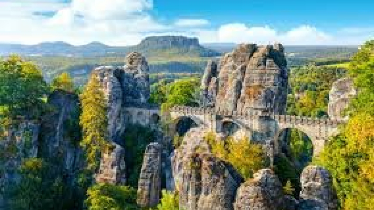

Sächsische Schweiz, also known as Saxon Switzerland, is a stunning sandstone rock landscape in Germany's Saxony state, straddling both banks of the Elbe River. It has held national park status since 1990. The region's iconic landmark is the 76.5-meter-long Bastei Bridge, dramatically stretched between towering rock formations. Access to the bridge is free, and there are no closing hours. Dresden serves as the gateway to the park, with the S1 train line departing every half hour. It travels through Pirna, Kurort Rathen, and Bad Schandau, extending all the way to the Czech border, making the region easily explorable without a car. As of August 2026, forest areas between Rathen and Polenztal are closed due to storm damage; however, the Bastei Bridge, viewpoints, and parking remain open. It's possible to visit both the Bastei Bridge and Königstein Fortress in a single day, while a two-day trip allows you to comfortably add a section of the famous Malerweg hiking trail to your itinerary. This guide will first cover the main attractions, followed by transportation, best seasons to visit, accommodation options, and essential park regulations.
Quick Facts
| Topic | Information |
|---|---|
| Location | Saxony state, Elbe Sandstone Mountains; adjacent to České Švýcarsko (Bohemian Switzerland) National Park on the Czech border |
| Protection Status | National Park declared in 1990, approximately 9,350 hectares (94 km²) |
| UNESCO | Not a UNESCO World Heritage site; protection comes from national park regulations |
| Key Highlight | Bastei rock formations and the 76.5-meter-long Bastei Bridge |
| Bastei Entrance | Free, open year-round, no closing hours |
| Current Status | Rathen-Polenztal forest trails closed due to storm damage; bridge and viewpoints open |
| Second Major Attraction | Königstein Fortress, on a rock plateau 247 meters above the Elbe |
| Transportation Backbone | S1 line from Dresden; Pirna, Kurort Rathen, Bad Schandau, Schöna |
| Hiking Backbone | Malerweg, eight stages, approximately 116 kilometers |
| Ideal Period | May-June and September-October |
| Accommodation Hubs | Bad Schandau, Kurort Rathen, Pirna |
| Visa | Conditions vary by nationality and are updated periodically; confirm with the German Federal Foreign Office before travel |
Bastei and Basteibrücke: Soaring 194 Meters Above the Elbe Valley
The Bastei is a breathtaking formation where sandstone towers line a dramatic rock ridge, suspended approximately 194 meters above the Elbe Valley. What makes the view truly spectacular isn't just the height, but the unique perspective itself: the river carves a wide curve below, while table mountains like Lilienstein and Königstein rise majestically on the opposite bank. The area is open year-round, with no entrance fee or closing hours.
The Bridge's Structure and Brief History
The bridge you cross today was constructed from sandstone in 1851, replacing an earlier wooden bridge that sources date back to the 1820s. This stone bridge spans 76.5 meters, gracefully arching across the chasm between the rock formations. For the best photographic angles, step a few paces away to one of the designated viewpoints, as the bridge itself is only fully visible when viewed from a distance, not while standing on it.
Felsenburg Neurathen Closed, Viewpoint Terrace Open
The medieval rock castle Felsenburg Neurathen, adjacent to the Bastei, has been closed to visitors since September 2023 due to millimeter-scale rock movements detected during regular measurements. As the original visitor route comprised wooden walkways built directly onto the rocks, there was no safety margin. However, a new viewpoint terrace, built on a more stable rock mass, has been open since 2023, offering the same stunning valley views. The Bastei Bridge remains unaffected by this closure.
Post-Storm: Current Trail Status
A localized storm that hit the Hohnstein area on the evening of July 31, 2026, toppled numerous trees across approximately 25 hectares, according to initial estimates by the national park administration. Consequently, forest areas between the Bastei, Rathen, Hohnstein, and Polenztal were closed starting August 1st. The Bastei viewpoint, bridge, and main parking lot remained open, and the Basteiweg leading down to Rathen reopened on August 7th, while Schwedenlöcher and Amselgrund remained closed. The district administration's closure order is valid until August 31, 2026, with restrictions being gradually eased. Before heading out, please check the Pirna district administration's forest page and the park's trail service for the latest updates.
How the Cliffs Were Formed
The region's distinctive rock formations originated during the Cretaceous period, at the bottom of a vast marine strait connecting the seas between Northern Germany and Bohemia. Over time, hundreds of meters of sediment layers fossilized into stone. After the Cretaceous sea receded, pressure from the Lusatian granite massif caused the landmass to uplift and fracture. Subsequent erosion by wind and water sculpted the dramatic, steep towers we see today. This same delicate structure explains why climbing is subject to strict regulations: sandstone is fragile when wet, and climbing is only permitted on officially designated peaks.
Königstein Fortress: A Garrison on a 247-Meter Rock Plateau
Königstein Fortress, one of Europe's largest mountain strongholds, is perched atop a flat-topped table mountain, 247 meters above the Elbe River. The fortress administration's exhibition, "In lapide regis," traces life on the plateau back approximately 800 years. Its most remarkable military aspect is that its defenses were never breached; for centuries, the structure served as a garrison, state treasury, and a place of detention.
What to See at the Fortress
The plateau is laid out like a sprawling promenade: a panoramic path stretches along the ramparts, offering distinct views from the Georgenburg bastion, the Lightning Oak plateau, and the King's Point promontory. Inside, you'll find historic barracks, armories, a deep well, and both permanent and temporary exhibitions. Allow about an hour and a half to complete the panoramic walk, and a good half-day to thoroughly explore the fortress.
Opening Hours and Ascent
The fortress is open from 09:00-18:00 between March 28th and November 1st, and from 09:00-17:00 between November 2nd and March 19th. Closing times are extended on Advent weekends, but it is closed on December 24th. Last entry is always one hour before closing. Ticket prices vary between high and low seasons, with discounted and family options available; confirm current rates on the fortress's official website before your visit. There are three ways to reach the plateau: a walking ramp, the panoramic elevator (included in the ticket price), and the Festungsexpress shuttle service departing from Königstein town.
The Malerweg: Eight Stages of the Painters' Way
The Malerweg, or "Painters' Way," is a long-distance hiking trail derived from the routes followed by artists who flocked to the region in the 18th and 19th centuries. According to the regional tourism board's current measurements, the trail is approximately 116 kilometers long, though older sources mention 112 kilometers. The official recommendation is to divide the route into eight daily stages, totaling about 46 hours of walking and approximately 3,600 meters of ascent. Individual stages range from 11 to 18 kilometers, making it feasible for day hikers to complete a single section.
Trail Stages
| Stage | Start | End | Character |
|---|---|---|---|
| 1 | Pirna-Liebethal | Stadt Wehlen | Valley entrance, warm-up stage |
| 2 | Stadt Wehlen | Hohnstein | Heart of the Bastei region |
| 3 | Hohnstein | Altendorf | Forests and stream beds |
| 4 | Altendorf | Neumannmühle | Kirnitzsch valley route |
| 5 | Neumannmühle | Schmilka | Steep section of the rear region |
| 6 | Schmilka | Kurort Gohrisch | Crossing to the left bank of the Elbe |
| 7 | Kurort Gohrisch | Weißig | Between the table mountains |
| 8 | Weißig | Pirna | Descent to the city, loop closes |
What to Pack
- Sturdy hiking boots with ankle support; sandstone can be slippery when wet, and steps are often narrow.
- Rain jacket and windbreaker; temperature differences between the valley floor and the plateau can change significantly throughout the day.
- Plenty of water; drinking fountains are scarce on the trails, and open fires are prohibited in the park, so hot drinks cannot be prepared en route.
- A printed or offline map; phone coverage can be patchy in the valleys.
- A small trash bag; all waste, including tissues, must be carried out of the park.
National Park Rules and Closures
Sächsische Schweiz is a strictly protected area; the park administration's code of conduct is summarized under the following headings.
| Topic | Rule |
|---|---|
| Trails | Access to the park is via existing paths; in the core zone, only marked or signposted trails are to be used |
| Drones | Flying drones and similar aerial vehicles is prohibited throughout the entire park |
| Tents and Camping | Pitching tents is forbidden; overnight stays in vehicles or caravans are also considered camping |
| Boofen (Rock Shelters) | Overnight stays under rock shelters (boofen) are permitted between June 16th and January 31st, for climbing purposes, and only at official boofen sites |
| Fire and Smoking | Smoking and all types of open fires are prohibited; campfires are only allowed in designated fire pits |
| Dogs | Must be kept on a leash |
| Bicycles | Only ridden on marked cycling routes within the park |
| Climbing | Only permitted on official climbing peaks and designated approach paths |
| Waste | All litter, including tissues, must be carried out |
There are also seasonal closures: storms, rock movements, and bird breeding seasons can temporarily close trails. The park's trail service page keeps this information updated.
Getting To and Around the Region
How to Get There from Turkey
Dresden is the main airport gateway to the region, though direct scheduled flights from Turkey are limited. Most travelers connect through major hubs like Berlin, Prague, Munich, or Frankfurt. Completing your journey by train is a practical option: Deutsche Bahn's 2026 timetable shows the fastest connection between Berlin and Dresden at 1 hour 34 minutes, while Dresden to Prague is around two and a quarter hours. Both routes offer frequent services throughout the day. From Dresden onwards, it's a regional train journey, so a long-distance ticket isn't required.
The S1 Line, Elbe Ferry, and Parking
The S1 suburban train line departs from Dresden Hauptbahnhof every half hour, traveling along the Elbe River through Pirna, Kurort Rathen, and Bad Schandau, all the way to Schöna on the Czech border.
A critical detail lies in Rathen: the station is located on the opposite bank of the Elbe, and you'll need to cross the river via a rope ferry to reach the Bastei. This ferry operates using the river's current, and its fare is not included in public transport tickets. After crossing, you'll walk through the car-free village, then embark on an uphill climb of approximately 30-45 minutes via the Basteiweg to reach the bridge.
For those arriving by car, paid parking lots are available near Lohmen; the walk from here to the bridge takes no more than fifteen minutes. On weekends and holidays, parking lots fill up early, so arriving before 9 AM will save you time. The Festungsexpress shuttle service, operating during the summer season, provides the connection between the Königstein stop and the fortress.
When to Visit: A Seasonal Guide
| Period | What to Expect | Note |
|---|---|---|
| March-April | Cool weather, bare forests, low crowds | Trails can be muddy, shorter daylight hours |
| May-June | Long days, green valleys, mild temperatures | Prime window for hiking |
| July-August | Hot and crowded | Prefer weekdays and early mornings |
| September-October | Changing colors, clear skies | Excellent for photography, facilities open |
| November-February | Fog, frost, short days | Bastei remains open, trails can be icy |
No matter which month you visit, the time of day is often more crucial than the season itself: a visitor arriving at the Bastei at 8 AM will experience the same view with a vastly different crowd than one arriving at noon.
Where to Stay, What to Eat
Accommodation Areas
There are three logical bases for accommodation in the region. Bad Schandau is the most balanced option, situated on the S1 line and home to the park's visitor center. The NationalparkZentrum is open Tuesday to Sunday from February to March, and daily from 09:00-17:00 between April and October, offering an excellent introduction to the area with its geology exhibition. Kurort Rathen is car-free, accessible by ferry, and the closest base to the Bastei, offering an advantage for early risers, though accommodation options are more limited. Pirna marks the beginning and end of the Malerweg; it's suitable for urban accommodation and day trips.
Saxon Cuisine
Saxon cuisine is wonderfully hearty after a day of hiking: expect dishes like Sauerbraten (marinated pot roast), potato-heavy soups, and local pastries to frequently appear on regional menus. Riverside restaurants tend to fill up in the late afternoon, so booking a table can save you time. Since open fires are prohibited in the park, plan your hot meals around the settlements in the valley.
Morning at the Bridge, Afternoon at the Fortress: A Two-Day Itinerary
The following itinerary allows visitors exploring without a car to make the most of two days.
- On your first day, take the S1 train from Dresden to Kurort Rathen early in the morning and cross the river via the rope ferry.
- Climb for 30-45 minutes via the Basteiweg to reach the bridge; spend some time at the viewpoint terrace before the crowds arrive.
- Towards midday, take a short tour on the open trails around the Bastei and check the day's closure list.
- In the afternoon, take the S1 train down to Königstein, ascend to the plateau via the Festungsexpress or walking ramp, and complete the panoramic path.
- In the evening, head to Bad Schandau for an overnight stay; start the next day with the visitor center's opening hours.
- On the second day, hike a section of the Malerweg as a day trip; since stage lengths range from 11-18 kilometers, make a note of your return train in advance.
- For your return, take the S1 train from Bad Schandau to Pirna or Dresden.
Handy Tips for Your Trip
- Check official sources for trail conditions on the morning of your hike; post-storm closures can change daily.
- Budget for the ferry fare separately, as train tickets do not cover this crossing.
- Sunrise and late afternoon offer optimal light and fewer crowds; midday is the busiest period on the bridge.
- Leave your drone in your bag; the ban applies throughout the entire park and is enforced.
- Not all cliff edges have railings, so families with children should maintain a safe distance.
For those seeking similar rock and canyon landscapes in Turkey, our Turkey nature and adventure tours category offers a great starting point. If you're planning an itinerary focused on castles and museums, explore our Turkey cultural tours. Travelers considering extending their European route south might find our Italy travel guide helpful, and those curious about German traveler habits can check out our article on German tourist profiles.
Frequently Asked Questions 6
Is there an entrance fee for the Bastei Bridge?
Access to the Bastei area and bridge is free, with no specific opening or closing hours. Paid items include parking fees and tickets for managed facilities like Königstein Fortress.
Is the Bastei Bridge open, and can Felsenburg Neurathen be visited?
The bridge is open for crossing. The adjacent rock castle, Felsenburg Neurathen, has been closed since September 2023 due to millimeter-scale rock movements detected during measurements. Instead, a new viewpoint terrace, built on a more stable rock mass, has been in use since 2023.
How long does it take to get from Rathen to the Bastei?
You'll need to disembark at the S1 station, cross the river by rope ferry, then walk uphill on the Basteiweg for approximately 30-45 minutes. For those coming from the parking lot near Lohmen, the walk takes no more than fifteen minutes.
Are drones and camping allowed in the park?
Drones and similar aerial vehicles are prohibited throughout the entire park. Pitching tents is also forbidden, and overnight stays in vehicles or caravans are considered camping. The exception is overnight stays under rock shelters (boofen) at official sites between June 16th and January 31st, specifically for climbing purposes.
Which months are best for visiting Sächsische Schweiz?
May-June and September-October are ideal for hiking, offering pleasant temperatures and long daylight hours. July and August are busy; weekdays and early mornings are recommended for a more relaxed experience. The area remains open in winter, but trails can become icy.
How long is the Malerweg, and how many stages does it have?
The trail is approximately 116 kilometers long according to current measurements, with an official recommendation of eight stages; older sources cite a length of 112 kilometers. The total walking time is about 46 hours, with a total ascent of approximately 3,600 meters, and stages vary between 11-18 kilometers.