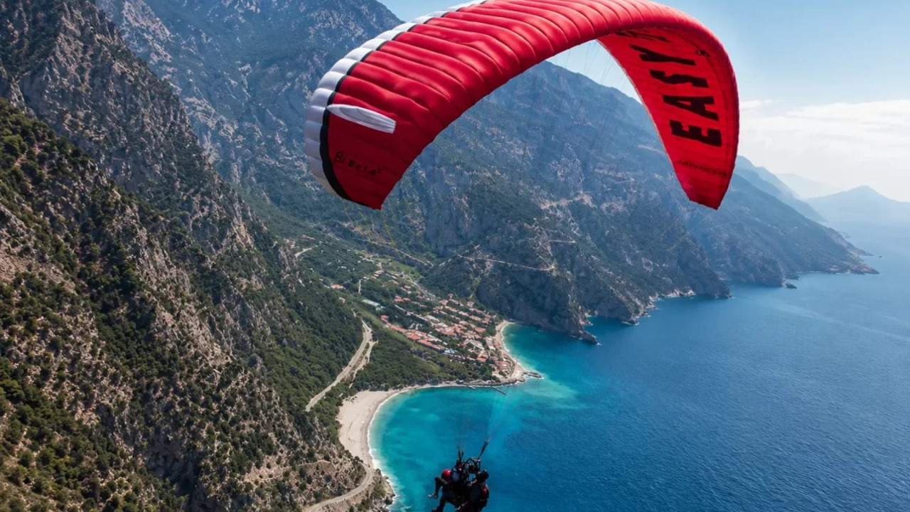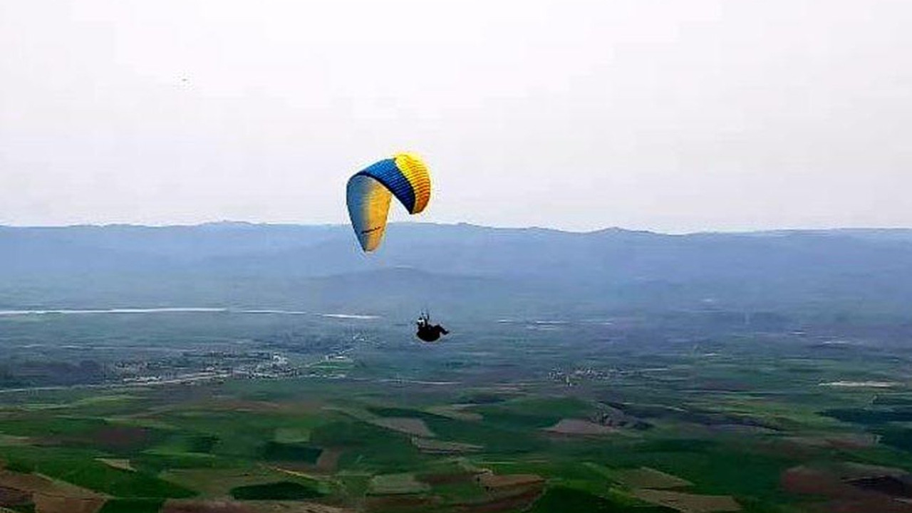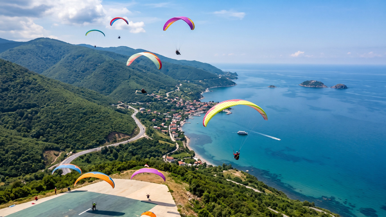
Uçmakdere, a stunning coastal village in the Şarköy district of Tekirdağ, is one of the most sought-after locations for aerial cinematography in the Marmara region. The dramatic geography, where the forested slopes of Ganos Dağı plunge almost vertically into the Marmara Sea, allows photographers to capture a striking contrast of lush greenery and deep blue waters in a single frame. While this landscape is a goldmine for drone operators and tandem paragliding passengers, it is technically demanding. Wind patterns shift rapidly throughout the day, takeoff points vary by altitude, and the airspace is bustling with paragliding traffic.
This guide breaks down the essentials of capturing professional aerial content in Uçmakdere into three core pillars: legal frameworks, geographical and meteorological conditions, and shooting techniques. Our goal is to help you plan your session meticulously so you can spend your time capturing the magic rather than troubleshooting on the fly.
Quick Reference Guide
Use this summary as a cheat sheet when planning your shoot.
| Topic | Details |
|---|---|
| Location | Uçmakdere Village, Şarköy, Tekirdağ |
| Coastal Stretch | Between Kumbağ and Mürefte |
| Geographic Features | Ganos Dağı foothills and Marmara Sea coastline |
| Takeoff Points | Two separate launch sites at 250m and 600m altitude |
| Distance from Istanbul | Approximately 170 km |
| Drive from Tekirdağ Center | Approx. 1 hour via winding mountain roads |
| Tandem Flight Duration | 250m site: 3-5 mins / 600m site: 8-15 mins |
| Drone Registration | Mandatory for devices 500g and above |
| Maximum Altitude | 120 meters (400 feet) |
| Best Flight Window | Sunrise to sunset, within visual line of sight (VLOS) |
| Peak Season | Year-round; Autumn is best for foliage colors |
What Makes Uçmakdere a Cinematic Powerhouse?
In aerial photography, the value of a location isn't just about height, it's about contrast. This is exactly where Uçmakdere shines.
The Intersection of Ganos Dağı and the Marmara Sea
The forest cover descends from the mountain peaks right down to the shoreline. For a drone operator, this means a single horizontal pan can transition from deep forest greens to turquoise shallows and finally to the deep blue of the open sea. In most coastal areas, this transition requires a long flight path; in Uçmakdere, it's compressed into a tight, visually dense area.
The autumn transition elevates this contrast. In October and November, the yellow and crimson hues of the slopes clash beautifully with the cool blue of the sea, creating frames that require almost no post-production color grading. In winter, the sea deepens and the landscape simplifies, offering a more graphic, minimalist aesthetic.
250m vs. 600m Launch Sites: Two Different Perspectives
Depending on the wind, pilots use one of two takeoff points: the 250-meter or the 600-meter site. From a cinematography perspective, these offer entirely different compositions.
The 600m site allows you to capture the entire coastline and the distant mountain range in one sweeping shot. This is where you establish the "epic scale" of the landscape using wide angles and slow movements. The 250m site brings you much closer to the water's surface, highlighting the texture of the waves, boats along the shore, and the intricate coastline. If you are booking a tandem flight, ask which site will be used to align your shot list. You can explore available options on the Uçmakdere Yamaç Paraşütü Turları page.
Coastal Orientation and Light Angles
Uçmakdere sits on the northern coast of the Marmara Sea, meaning the water is to the south. This is the most critical piece of information for timing your shoot. In the morning, light comes from the east, grazing the coastline and highlighting the textures of the slopes. Midday light is harsh and vertical, causing the sea to glare and shadows to disappear, making it the least productive time for aerials. Late afternoon brings light from the west, backlighting the slopes and creating long, dramatic shadows that add volume to the landscape.
Drone Regulations and Safety Guidelines
Drone operations in Uçmakdere are subject to Turkish civil aviation laws. Ignorance of these rules can lead to administrative fines or equipment seizure.
Registration and Pilot Certification
Any drone with a maximum takeoff weight of 500 grams or more must be registered with the national system. Once registered, the provided QR code should be clearly visible on the device. Categories are based on weight: UAV-0 (500g to 4kg) and UAV-1 (4kg to 25kg).
Many consumer drones hover right around the 500g mark. Do not assume your device is "exempt" without weighing it with the battery and propellers attached. If you are shooting for commercial purposes, additional pilot certifications and permits are required.
Altitude, Line of Sight, and No-Fly Zones
The following table summarizes the most frequently overlooked operational limits.
| Rule | Application |
|---|---|
| Max Altitude | 120 meters (400 feet) above ground level (AGL) |
| Visual Line of Sight | Device must remain visible to the pilot at all times |
| Flight Window | Sunrise to sunset |
| Airport Proximity | No flying within a 5 nautical mile (approx. 9km) radius |
| Distance from People | Maintain a minimum distance of 50 meters |
| Crowds | Flying over large gatherings is prohibited |
| Restricted Areas | No-fly zones near military or critical infrastructure (check NOTAMs) |
| Visibility | Minimum meteorological visibility of 2 km |
Crucial Note: The 120-meter limit is measured from the ground, not sea level. If you launch from the 600m peak, you are already at 600m relative to the sea, but your altitude limit is 120m above that peak. As you fly down the slope, the distance between your drone and the terrain changes rapidly; always monitor your altitude relative to the land beneath you, not your takeoff point.
Additionally, some local governorates may require prior notification to local law enforcement. Confirming the current local status before you arrive will prevent unnecessary disputes on site.
Sharing the Sky with Paragliders
This is the most critical operational difference in Uçmakdere. The area is a hub for tandem and solo paragliding. During peak season, an average of 500 flights occur weekly, with some reports indicating that autumn traffic can even exceed summer peaks.
For a drone operator, this means the air is crowded. A paraglider has a wide turning radius and can change altitude rapidly while circling in a thermal. A pilot is less likely to see your drone than you are to see them. Follow these strict rules:
- Avoid Launch and Landing Zones: These are high-traffic operational areas. Keep your drone clear.
- Never Fly Beneath or Behind a Wing: This creates turbulence and a high risk of collision.
- Pause During Peak Traffic: If the sky is full of wings, wait for a lull in activity.
- Coordinate with Ground Crew: Talk to the site operators; they know exactly which corridors will be clear.
- Maintain Vertical Separation: Never approach a wing horizontally at the same altitude; always keep a significant height difference.
Getting to Uçmakdere and Planning Your Shoot Day
Access to Uçmakdere is via the Tekirdağ-Şarköy highway, following a winding road along the foothills of the Ganos Mountains. Because of the terrain, the drive takes longer than the mileage suggests.
| Transport Option | Notes |
|---|---|
| Private Car | Via Tekirdağ-Şarköy road; approx. 1 hour of mountain driving |
| From Istanbul | Approx. 170 km via the coastal road and Ganos pass |
| Public Transport | Minibuses from Tekirdağ bus station; more frequent in summer |
| Tour Operator Transfer | Shuttles available depending on the flight package |
To maximize your efficiency, plan your day in this order:
- Weather Check (24h prior): Check wind speed, direction, and cloud base. If rain is forecast, postpone; wet wings and wet drones don't fly.
- Early Arrival & Scouting: Don't launch immediately. Scout the slope line, landing zones, and power lines from the ground first.
- Coordinate with Site Staff: Find out which launch site is active and when the peak flight windows are.
- Morning Test Session: Keep the first flight short. Test battery performance in the wind and calibrate your settings.
- Midday Maintenance: Charge batteries, clean lenses of salt and dust, and back up your footage.
- Golden Hour Positioning: Light changes fast. Have your composition ready before the sun hits the perfect angle.
- Pack Up Before Sunset: Flying after sunset is against regulations and significantly increases landing risks.
Capturing Footage During a Tandem Flight
The second way to get aerials isn't a drone, but shooting directly from the wing. In Uçmakdere, there is a catch: the glide isn't as long as you might think. Depending on the site, flights last 3-5 minutes (250m site) or 8-15 minutes (600m site). You don't have time to "find the shot" in the air; you must decide your composition before takeoff.
Gear Security and Stability
Carrying a loose device during a tandem flight is strictly prohibited. Whether it's a phone or an action camera, it must be secured with a lanyard, wrist strap, or a chest mount. A dropped device is a danger to you and everyone on the ground. You will need to show your gear's secure attachment to the pilot during the pre-flight safety check.
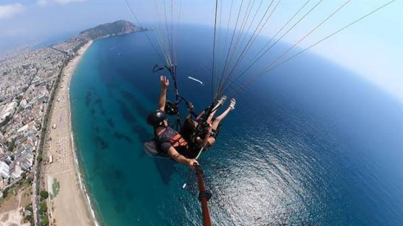
Some operators provide their own camera and selfie-stick setups. If you use theirs, the pilot controls the composition; if you use your own, you have control but bear all the responsibility. Clarify this during your booking.
Settings and Angles
The most common mistake in wing-mounted shots is letting the paraglider wing occupy too much of the frame. Instead of pointing the camera straight up, angle it slightly down and to the side. Let a corner of the wing be visible to provide scale, leaving the rest of the frame for the landscape. Use a high frame rate to smooth out wing vibrations, allowing for cinematic slow-motion in post.
Wind noise will overwhelm your microphone; don't rely on raw audio. Plan to replace it with music or a voiceover. To combat the glare of the sea, slightly underexpose your shot to preserve the details in the sky and water. Avoid extreme wide angles, as they flatten the perspective and make a 600m drop look like 100m; a slightly narrower field of view preserves the sense of altitude.

How Light, Wind, and Season Change the Frame
Wind in Uçmakdere follows a predictable daily cycle. As the land heats up, a sea breeze blows inland, providing the lift needed for paragliders. As the evening cools, the direction often shifts. For drone pilots, this "lift" is a challenge: it makes hovering difficult and drains batteries faster.
Thermal currents, rising columns of warm air, are a hallmark of the region. While thermals help pilots gain altitude, they cause drones to experience sudden altitude shifts and "jittery" footage. Midday, when thermal activity is strongest, is the most challenging time for stable aerial cinematography.
| Period | Light & Air Characteristics | Best Shot |
|---|---|---|
| Early Morning | Soft side-lighting, calm air, weak thermals | Coastal textures, morning mist, sea details |
| Midday | Harsh overhead light, strong thermals, high glare | Inefficient for shooting; best for backup/charging |
| Late Afternoon | Warm western light, long shadows | Mountain volume, wing silhouettes, panoramas |
| Spring | Variable winds, fresh green foliage | High-saturation slope shots |
| Summer | Heavy flight traffic, powerful thermals | Crowded skies with colorful wings, deep blue sea |
| Autumn | Color transitions, high traffic volume | Contrast between red/yellow forests and blue sea |
| Winter | Darker sea, low sun angle, sparse traffic | Minimalist, graphic compositions |
If you want to add other activities to your itinerary, the Uçmakdere turları page is a great place to start.
Essential Gear and Settings for Coastal Aerials
Shooting in a mountain-meets-sea environment requires different preparation than urban filming. Check these off your list:
- Extra Batteries: Fighting wind consumes power rapidly; bring more than you think you need.
- ND Filter Set: The reflection from the sea and bright sky can blow out your highlights. ND filters are essential for natural motion blur.
- Backup Storage: Don't leave your SD cards in a hot car; copy footage to a second drive throughout the day.
- Salt & Moisture Protection: Coastal air leaves residue on lenses and motors. Clean your gear with a dry microfiber cloth after every session.
- Compass & GPS Calibration: Mountainous terrain can cause interference. Calibrate your drone immediately before takeoff.
- Sturdy Boots & Windbreaker: The launch sites are on slopes where the air is significantly cooler than at the beach.
- Registration Docs & QR Code: Keep your UAV registration documents easily accessible.
- Emergency Landing Plan: Before you start your cinematic orbit, identify a safe spot to land if the battery drops.
Common Mistakes and How to Fix Them
A few recurring errors often ruin a shoot day. Here are the shortcuts to professional results:
- Reading Altitude via Sea Level: Remember, the 120m limit is relative to the ground beneath you, not the sea.
- Starting the Shoot at Noon: The combination of harsh light and strong thermals ruins both exposure and stability.
- Ignoring Paraglider Traffic: Flying in a busy glide path isn't just a rule violation; it's a safety hazard.
- Ignoring Wind Forecasts: The sea breeze and thermal cycles change several times a day.
- Flying Tandem Without Securing Gear: A loose camera will not be permitted during the pre-flight check.
- Relying on Raw Audio: Wind noise is impossible to "fix" in post. Plan your sound design from the start.
For those looking to combine paragliding and aerial photography in other regions, our yamaç paraşütü turları page offers several alternative locations.
Ultimately, great aerial content in Uçmakdere is more about planning than expensive gear. An operator who understands the rules, reads the wind, and times the light can produce stunning results with mid-range equipment. Without that planning, even the most expensive drone will only capture a glare on the water.
Frequently Asked Questions 6
Do I need a permit to fly a drone in Uçmakdere?
Devices with a maximum takeoff weight of 500g or more must be registered with the national UAV registration system. Flights must occur between sunrise and sunset, within visual line of sight, and not exceed 120 meters above ground level. Commercial shoots require pilot certification and additional permits.
Can I use my own camera during a tandem flight?
This depends on the operator. If permitted, the device must be secured via a lanyard, wrist strap, or chest mount; loose devices are not allowed during safety checks. Many operators offer their own camera and selfie-stick services.
What is the best time of day for aerial shooting?
Early morning and the golden hour before sunset are the most productive. Mornings are calmer with weaker thermal activity, while late afternoon light creates depth and volume on the slopes. Midday is generally avoided due to harsh lighting and strong thermals.
How long does a paragliding flight last, and how much footage can I get?
Flight duration depends on the launch site and wind. In Uçmakdere, flights from the 250m site typically last 3-5 minutes, while the 600m site offers 8-15 minutes. Plan specific shots before takeoff to maximize usable footage.
How is the 120-meter drone limit measured in Uçmakdere?
The 120-meter limit is measured from the ground (AGL), not sea level. If you launch from the 600m peak, your limit is 120m above that takeoff point. Always monitor your altitude relative to the terrain immediately below the drone.
Which season is best for aerial photography?
Autumn is visually superior due to the changing colors of the Ganos Dağı forests. Summer offers vibrant blue seas and high flight traffic, while winter provides a more minimalist, graphic look with a darker sea.